

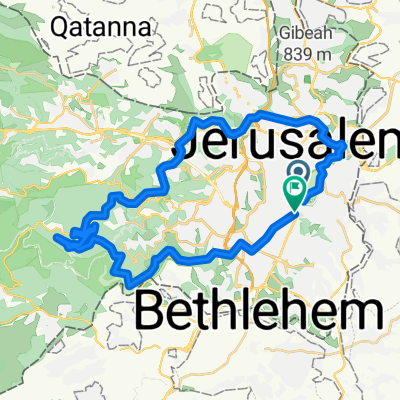
יום כיפור 22
A cycling route starting in Old City, West Bank, Palestine.
Overview
About this route
- -:--
- Duration
- 22.6 km
- Distance
- 521 m
- Ascent
- 520 m
- Descent
- ---
- Avg. speed
- 822 m
- Max. altitude

Continue with Bikemap
Use, edit, or download this cycling route
You would like to ride יום כיפור 22 or customize it for your own trip? Here is what you can do with this Bikemap route:
Free features
- Save this route as favorite or in collections
- Copy & plan your own version of this route
- Sync your route with Garmin or Wahoo
Premium features
Free trial for 3 days, or one-time payment. More about Bikemap Premium.
- Navigate this route on iOS & Android
- Export a GPX / KML file of this route
- Create your custom printout (try it for free)
- Download this route for offline navigation
Discover more Premium features.
Get Bikemap PremiumFrom our community
Other popular routes starting in Old City
 Short ride through Jerusalem
- Distance
- 9.4 km
- Ascent
- 148 m
- Descent
- 120 m
- Location
- Old City, West Bank, Palestine
 ירושלים מורחב
- Distance
- 47.6 km
- Ascent
- 1,138 m
- Descent
- 1,137 m
- Location
- Old City, West Bank, Palestine
 סובב ירושלים
- Distance
- 38.4 km
- Ascent
- 603 m
- Descent
- 606 m
- Location
- Old City, West Bank, Palestine
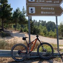 Yad Kennedy hill climb.
- Distance
- 31.2 km
- Ascent
- 881 m
- Descent
- 856 m
- Location
- Old City, West Bank, Palestine
 sataf.png
- Distance
- 28.5 km
- Ascent
- 702 m
- Descent
- 651 m
- Location
- Old City, West Bank, Palestine
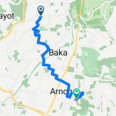 From West Jerusalem to East Jerusalem
- Distance
- 5.1 km
- Ascent
- 102 m
- Descent
- 100 m
- Location
- Old City, West Bank, Palestine
 Shimshon Street 10, Jerusalem to Shimshon Street 10, Jerusalem
- Distance
- 30.4 km
- Ascent
- 526 m
- Descent
- 523 m
- Location
- Old City, West Bank, Palestine
 ירושלים,פארק המסילה,חרבת סעדים,מנהרת כרם,רכיבה לזכרו של יעקב
- Distance
- 29.6 km
- Ascent
- 387 m
- Descent
- 397 m
- Location
- Old City, West Bank, Palestine
Open it in the app