

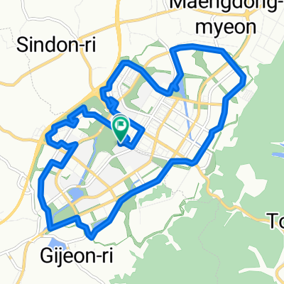
Day#5
A cycling route starting in Chinch'ŏn, North Chungcheong, South Korea.
Overview
About this route
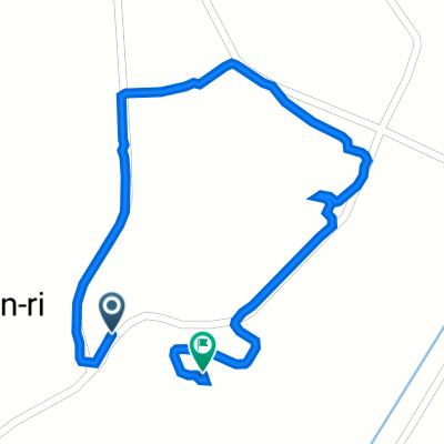
Gyeryongsan National Park
682-1 Hakbong-ri, Banpo-myeon, Gongju-si, Chungcheongnam-do, South Korea
- -:--
- Duration
- 73.3 km
- Distance
- 585 m
- Ascent
- 498 m
- Descent
- ---
- Avg. speed
- 132 m
- Max. altitude
Route quality
Waytypes & surfaces along the route
Waytypes
Cycleway
41.1 km
(56 %)
Quiet road
13.9 km
(19 %)
Surfaces
Paved
33 km
(45 %)
Asphalt
21.3 km
(29 %)
Concrete
11.7 km
(16 %)
Undefined
40.3 km
(55 %)
Continue with Bikemap
Use, edit, or download this cycling route
You would like to ride Day#5 or customize it for your own trip? Here is what you can do with this Bikemap route:
Free features
- Save this route as favorite or in collections
- Copy & plan your own version of this route
- Sync your route with Garmin or Wahoo
Premium features
Free trial for 3 days, or one-time payment. More about Bikemap Premium.
- Navigate this route on iOS & Android
- Export a GPX / KML file of this route
- Create your custom printout (try it for free)
- Download this route for offline navigation
Discover more Premium features.
Get Bikemap PremiumFrom our community
Other popular routes starting in Chinch'ŏn
 jinanro-saeulgil
- Distance
- 5.4 km
- Ascent
- 278 m
- Descent
- 52 m
- Location
- Chinch'ŏn, North Chungcheong, South Korea
 대소면 220-11, 음성군 ~ 대소면 5-3, 음성군
- Distance
- 1.8 km
- Ascent
- 15 m
- Descent
- 13 m
- Location
- Chinch'ŏn, North Chungcheong, South Korea
 진천군에서 진천군까지
- Distance
- 15 km
- Ascent
- 130 m
- Descent
- 131 m
- Location
- Chinch'ŏn, North Chungcheong, South Korea
 초평저수지
초평저수지- Distance
- 17.4 km
- Ascent
- 223 m
- Descent
- 248 m
- Location
- Chinch'ŏn, North Chungcheong, South Korea
 대소면 231-8, 음성군 ~ 대소면 220-6, 음성군
- Distance
- 1.2 km
- Ascent
- 10 m
- Descent
- 8 m
- Location
- Chinch'ŏn, North Chungcheong, South Korea
 증평읍 100, 증평군 ~ 문암동 94-10, 청주시
- Distance
- 22.8 km
- Ascent
- 7 m
- Descent
- 78 m
- Location
- Chinch'ŏn, North Chungcheong, South Korea
 진천군에서 진천군까지
- Distance
- 10.5 km
- Ascent
- 153 m
- Descent
- 152 m
- Location
- Chinch'ŏn, North Chungcheong, South Korea
 진천읍 97-13, 진천군 ~ 진천읍 산106-15, 진천군
- Distance
- 24 km
- Ascent
- 60 m
- Descent
- 85 m
- Location
- Chinch'ŏn, North Chungcheong, South Korea
Open it in the app