

Inca, Mallorca
Mallorca: Inca-coll de sa Batalla-Fornalutx-Sóller
A cycling route starting in Inca, Balearic Islands, Spain.
Overview
About this route
Beautiful Tramuntana track
- -:--
- Duration
- 49.8 km
- Distance
- 1,359 m
- Ascent
- 1,466 m
- Descent
- ---
- Avg. speed
- 1,040 m
- Max. altitude

Part of
Inca, Mallorca
13 stages
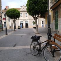
Route photos


Route quality
Waytypes & surfaces along the route
Waytypes
Quiet road
11.9 km
(24 %)
Road
3.5 km
(7 %)
Surfaces
Paved
46.8 km
(94 %)
Asphalt
46.8 km
(94 %)
Undefined
3 km
(6 %)
Continue with Bikemap
Use, edit, or download this cycling route
You would like to ride Mallorca: Inca-coll de sa Batalla-Fornalutx-Sóller or customize it for your own trip? Here is what you can do with this Bikemap route:
Free features
- Save this route as favorite or in collections
- Copy & plan your own version of this route
- Sync your route with Garmin or Wahoo
Premium features
Free trial for 3 days, or one-time payment. More about Bikemap Premium.
- Navigate this route on iOS & Android
- Export a GPX / KML file of this route
- Create your custom printout (try it for free)
- Download this route for offline navigation
Discover more Premium features.
Get Bikemap PremiumFrom our community
Other popular routes starting in Inca
 SENCELLES-LLORET-SANT JOAN-PETRA-COMUNES-CAN PICAFORT-SA POBLA-INCA
- Distance
- 80.5 km
- Ascent
- 402 m
- Descent
- 423 m
- Location
- Inca, Balearic Islands, Spain
 Mallorca: Inca-coll de sa Batalla-Fornalutx-Sóller
- Distance
- 49.8 km
- Ascent
- 1,359 m
- Descent
- 1,466 m
- Location
- Inca, Balearic Islands, Spain
 SENCELLES-ALGAIDA-LLUCMAJOR-CAMPOS-PORRERES-INCA
- Distance
- 90.6 km
- Ascent
- 365 m
- Descent
- 377 m
- Location
- Inca, Balearic Islands, Spain
 CAMPANET- POLLENÇA-ALCUDIA-CAN PICAFORT-SA POBLA-INCA
- Distance
- 77.7 km
- Ascent
- 278 m
- Descent
- 291 m
- Location
- Inca, Balearic Islands, Spain
 Tramuntana Runde + Sa Calobra
- Distance
- 147.6 km
- Ascent
- 2,101 m
- Descent
- 2,100 m
- Location
- Inca, Balearic Islands, Spain
 RR Inca SaCalobra Bunyola 120k 3000h
- Distance
- 120.9 km
- Ascent
- 6,124 m
- Descent
- 6,123 m
- Location
- Inca, Balearic Islands, Spain
 POLLENÇA-COLL DE FEMENIA-COLL DE SA BATALLA
- Distance
- 67.9 km
- Ascent
- 857 m
- Descent
- 860 m
- Location
- Inca, Balearic Islands, Spain
 CAMI VELL DE BINIAMAR-COMUNA-MANCOR-FONT DES GARROVER-LLOSETA
- Distance
- 30 km
- Ascent
- 480 m
- Descent
- 505 m
- Location
- Inca, Balearic Islands, Spain
Open it in the app