

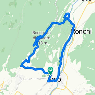
4.The Sarca Valley and Lake Cavedine: from Arco to Sarche
A cycling route starting in Arco, Trentino-Alto Adige, Italy.
Overview
About this route
This route takes you on a tour of the northern part of Garda Trentino. Starting from Arco you get as far as Sarche and Lake Cavedine before heading back to the departure point.
- 2 h 14 min
- Duration
- 36.7 km
- Distance
- 396 m
- Ascent
- 395 m
- Descent
- 16.5 km/h
- Avg. speed
- 279 m
- Max. altitude
Route quality
Waytypes & surfaces along the route
Waytypes
Quiet road
12.5 km
(34 %)
Cycleway
12.1 km
(33 %)
Surfaces
Paved
33.8 km
(92 %)
Asphalt
33.8 km
(92 %)
Undefined
2.9 km
(8 %)
Continue with Bikemap
Use, edit, or download this cycling route
You would like to ride 4.The Sarca Valley and Lake Cavedine: from Arco to Sarche or customize it for your own trip? Here is what you can do with this Bikemap route:
Free features
- Save this route as favorite or in collections
- Copy & plan your own version of this route
- Sync your route with Garmin or Wahoo
Premium features
Free trial for 3 days, or one-time payment. More about Bikemap Premium.
- Navigate this route on iOS & Android
- Export a GPX / KML file of this route
- Create your custom printout (try it for free)
- Download this route for offline navigation
Discover more Premium features.
Get Bikemap PremiumFrom our community
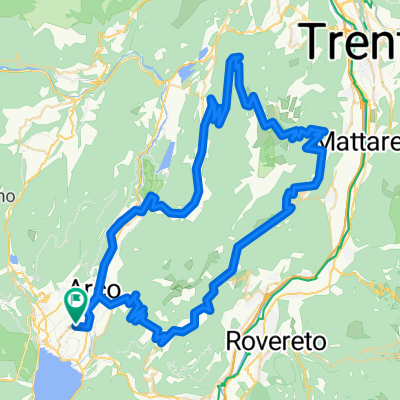
Other popular routes starting in Arco
 arco
arco- Distance
- 14.3 km
- Ascent
- 620 m
- Descent
- 620 m
- Location
- Arco, Trentino-Alto Adige, Italy
 Arco Tennosee
- Distance
- 60.9 km
- Ascent
- 1,004 m
- Descent
- 1,023 m
- Location
- Arco, Trentino-Alto Adige, Italy
 Garda_Tour 1
- Distance
- 143.7 km
- Ascent
- 2,886 m
- Descent
- 2,883 m
- Location
- Arco, Trentino-Alto Adige, Italy
 Arco, Race, 101 km, 3000 Hm, Monte Velo - Umrundung Monte Bordone, Var 2
- Distance
- 98.4 km
- Ascent
- 3,267 m
- Descent
- 3,266 m
- Location
- Arco, Trentino-Alto Adige, Italy
 Arco, MTB, 042 km, 1500 Hm, Monte Velo Trail, schwer
- Distance
- 41.5 km
- Ascent
- 1,409 m
- Descent
- 1,407 m
- Location
- Arco, Trentino-Alto Adige, Italy
 Monte Velo
- Distance
- 32.8 km
- Ascent
- 1,266 m
- Descent
- 1,266 m
- Location
- Arco, Trentino-Alto Adige, Italy
 Arco - Passo S.Giovanni - Arco
- Distance
- 33.2 km
- Ascent
- 1,163 m
- Descent
- 1,165 m
- Location
- Arco, Trentino-Alto Adige, Italy
 Arco - Santa Barbara
- Distance
- 39 km
- Ascent
- 1,135 m
- Descent
- 1,132 m
- Location
- Arco, Trentino-Alto Adige, Italy
Open it in the app