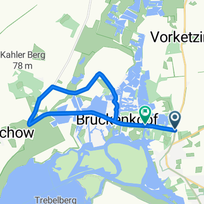
Golm - Havelradweg
A cycling route starting in Ketzin, Brandenburg, Germany.
Overview
About this route
The Nordic skiroller dream in western Potsdam! The Havelradweg, along with the Fläming-Skate south of Berlin, is one of the most beautiful routes in our region. Starting here in Potsdam at Golm station. From here, head towards Werder. The first short section is on the road until you reach a very secluded road leading to the Werder railway bridge. Cross the bridge on foot and then continue with skirollers/cross-skates over the station to the cycle path to Phöben. The cycle path ends around the entrance of Phöben. Here, you still need to ride a short section on the road through Phöben until you can turn right in the village onto the Havelradweg. Then it’s mostly traffic-free again, going almost exclusively through nature! If you don’t want to ride on the road, it’s best to start in Phöben on the Havelradweg (see route Phöben - Havelradweg).
- 2 h 38 min
- Duration
- 43.9 km
- Distance
- 92 m
- Ascent
- 93 m
- Descent
- 16.7 km/h
- Avg. speed
- 52 m
- Max. altitude
Route quality
Waytypes & surfaces along the route
Waytypes
Path
34.7 km
(79 %)
Quiet road
4.8 km
(11 %)
Surfaces
Paved
43.9 km
(100 %)
Asphalt
43.5 km
(99 %)
Concrete
0.4 km
(1 %)
Continue with Bikemap
Use, edit, or download this cycling route
You would like to ride Golm - Havelradweg or customize it for your own trip? Here is what you can do with this Bikemap route:
Free features
- Save this route as favorite or in collections
- Copy & plan your own version of this route
- Sync your route with Garmin or Wahoo
Premium features
Free trial for 3 days, or one-time payment. More about Bikemap Premium.
- Navigate this route on iOS & Android
- Export a GPX / KML file of this route
- Create your custom printout (try it for free)
- Download this route for offline navigation
Discover more Premium features.
Get Bikemap PremiumFrom our community
Other popular routes starting in Ketzin
 DEETZ
DEETZ- Distance
- 29.2 km
- Ascent
- 90 m
- Descent
- 93 m
- Location
- Ketzin, Brandenburg, Germany
 Ketzin (südl. d. Havel) -> Brandenburg (nördl. d. Havel) Ketzin (Rundkurs)
- Distance
- 55 km
- Ascent
- 64 m
- Descent
- 65 m
- Location
- Ketzin, Brandenburg, Germany
 Route 7 Pfaueninsel(zurück gleiche Route)
- Distance
- 27 km
- Ascent
- 147 m
- Descent
- 146 m
- Location
- Ketzin, Brandenburg, Germany
 Ketzin - Werder/Havel
- Distance
- 18.2 km
- Ascent
- 45 m
- Descent
- 43 m
- Location
- Ketzin, Brandenburg, Germany
 Havellandradtour 4. Tag (13.05.2013)
- Distance
- 54.5 km
- Ascent
- 74 m
- Descent
- 73 m
- Location
- Ketzin, Brandenburg, Germany
 Ketzin 1
- Distance
- 41.8 km
- Ascent
- 21 m
- Descent
- 22 m
- Location
- Ketzin, Brandenburg, Germany
 Brückenkopf
- Distance
- 8.9 km
- Ascent
- 13 m
- Descent
- 13 m
- Location
- Ketzin, Brandenburg, Germany
 Tour 3 Brandenburg
- Distance
- 58 km
- Ascent
- 135 m
- Descent
- 130 m
- Location
- Ketzin, Brandenburg, Germany
Open it in the app


