

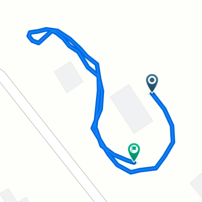
Pea Ridge AR - Washburn MO around and back
A cycling route starting in Pea Ridge, Arkansas, United States.
Overview
About this route
No cell phone service on Hwy 90, Hwy KK and on the northern part of Hwy 265. Some hills and some flats. Not bad as long as you have a buddy to ride with. Washburn is the last water stop so make sure you fill up your bottles before seting off on Hwy 90.
- -:--
- Duration
- 76.3 km
- Distance
- 391 m
- Ascent
- 394 m
- Descent
- ---
- Avg. speed
- ---
- Max. altitude
Route quality
Waytypes & surfaces along the route
Waytypes
Road
22.1 km
(29 %)
Quiet road
22.1 km
(29 %)
Undefined
32 km
(42 %)
Surfaces
Paved
35.1 km
(46 %)
Paved (undefined)
25.2 km
(33 %)
Asphalt
9.9 km
(13 %)
Undefined
41.2 km
(54 %)
Continue with Bikemap
Use, edit, or download this cycling route
You would like to ride Pea Ridge AR - Washburn MO around and back or customize it for your own trip? Here is what you can do with this Bikemap route:
Free features
- Save this route as favorite or in collections
- Copy & plan your own version of this route
- Sync your route with Garmin or Wahoo
Premium features
Free trial for 3 days, or one-time payment. More about Bikemap Premium.
- Navigate this route on iOS & Android
- Export a GPX / KML file of this route
- Create your custom printout (try it for free)
- Download this route for offline navigation
Discover more Premium features.
Get Bikemap PremiumFrom our community
Other popular routes starting in Pea Ridge
 PRidge Park Rogers Bville BVista around and back
- Distance
- 60.3 km
- Ascent
- 304 m
- Descent
- 304 m
- Location
- Pea Ridge, Arkansas, United States
 Rogers Bville BVista around and back
- Distance
- 48.1 km
- Ascent
- 271 m
- Descent
- 271 m
- Location
- Pea Ridge, Arkansas, United States
 1705 Shelby St, Pea Ridge to 201 SW 14th St, Bentonville
- Distance
- 16 km
- Ascent
- 147 m
- Descent
- 148 m
- Location
- Pea Ridge, Arkansas, United States
 Pea Ridge AR - Washburn MO around and back
- Distance
- 76.3 km
- Ascent
- 391 m
- Descent
- 394 m
- Location
- Pea Ridge, Arkansas, United States
 11 Ettington Dr, Bella Vista to 11 Ettington Dr, Bella Vista
- Distance
- 12.9 km
- Ascent
- 136 m
- Descent
- 130 m
- Location
- Pea Ridge, Arkansas, United States
 Posy Mountain around and back
- Distance
- 48.2 km
- Ascent
- 377 m
- Descent
- 377 m
- Location
- Pea Ridge, Arkansas, United States
 11 Ettington Dr, Bella Vista to 11 Ettington Dr, Bella Vista
- Distance
- 2.1 km
- Ascent
- 33 m
- Descent
- 38 m
- Location
- Pea Ridge, Arkansas, United States
 test loop
- Distance
- 0.6 km
- Ascent
- 26 m
- Descent
- 15 m
- Location
- Pea Ridge, Arkansas, United States
Open it in the app