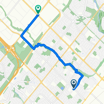
Culham Trails Down to Lakeshore, Up from Port Credit
A cycling route starting in Mississauga, Ontario, Canada.
Overview
About this route
OVERVIEW: A great route with paved trails, however it will be unpaved throughout the Culham and Riverwood Trails. This route wll take you in the forest, along the lake, through the heart of the city, and more! Have fun!
ROUTE DESCRIPTION: This trail takes us from Celebration Square, Mississauga, down Riverwood to the Culham Trail. We will head straight on Mississauga Road all the way down to the Sheridan Trail, in which a series of trails will be taken down to the Waterfront Trail. This trail will take us to Port Credit, entering Jack Darling Memorial Park, Breuckner Rhododendron Gardens, ansd J.C. Saddington Park. Finally, we will head north briefly on Hurontario, then we will continue on the Cooksville Trail, where we will turn left on Burnhamthorpe trail and complete the loop.
- -:--
- Duration
- 36.1 km
- Distance
- 254 m
- Ascent
- 254 m
- Descent
- ---
- Avg. speed
- 161 m
- Avg. speed
Route quality
Waytypes & surfaces along the route
Waytypes
Cycleway
19.3 km
(54 %)
Quiet road
7.7 km
(21 %)
Surfaces
Paved
28.3 km
(78 %)
Unpaved
2.3 km
(6 %)
Asphalt
26.6 km
(74 %)
Gravel
1.6 km
(5 %)
Continue with Bikemap
Use, edit, or download this cycling route
You would like to ride Culham Trails Down to Lakeshore, Up from Port Credit or customize it for your own trip? Here is what you can do with this Bikemap route:
Free features
- Save this route as favorite or in collections
- Copy & plan your own version of this route
- Sync your route with Garmin or Wahoo
Premium features
Free trial for 3 days, or one-time payment. More about Bikemap Premium.
- Navigate this route on iOS & Android
- Export a GPX / KML file of this route
- Create your custom printout (try it for free)
- Download this route for offline navigation
Discover more Premium features.
Get Bikemap PremiumFrom our community
Other popular routes starting in Mississauga
- Day2_Missiisauga to Niagara Falls
- Distance
- 119.8 km
- Ascent
- 385 m
- Descent
- 354 m
- Location
- Mississauga, Ontario, Canada
- Riverwood-SawmillValley-Culham Loop
- Distance
- 10.1 km
- Ascent
- 90 m
- Descent
- 93 m
- Location
- Mississauga, Ontario, Canada
- Violet Road 4449, Mississauga to Violet Road 4449, Mississauga
- Distance
- 11.9 km
- Ascent
- 83 m
- Descent
- 52 m
- Location
- Mississauga, Ontario, Canada
- Etobicoke-Lakeshore-Miss Road
- Distance
- 40.5 km
- Ascent
- 133 m
- Descent
- 131 m
- Location
- Mississauga, Ontario, Canada
- belfountain ride
- Distance
- 74 km
- Ascent
- 405 m
- Descent
- 405 m
- Location
- Mississauga, Ontario, Canada
- 2689 Hollington Cres, Mississauga to 2652 Hollington Cres, Mississauga
- Distance
- 16.2 km
- Ascent
- 162 m
- Descent
- 161 m
- Location
- Mississauga, Ontario, Canada
- MBRC-Campbellville via Hwy25 Speyside climb 52km
- Distance
- 52.1 km
- Ascent
- 235 m
- Descent
- 121 m
- Location
- Mississauga, Ontario, Canada
- Windwood Drive 2881, Mississauga to Financial Drive 7987, Brampton
- Distance
- 9.9 km
- Ascent
- 73 m
- Descent
- 78 m
- Location
- Mississauga, Ontario, Canada
Open it in the app