

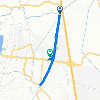
De San Lorenzo Rio Tenco, Cuautitlán Izcalli a Estado de México
A cycling route starting in San José del Puente, State of Mexico, Mexico.
Overview
About this route
- 3 h 46 min
- Duration
- 48.6 km
- Distance
- 1,395 m
- Ascent
- 822 m
- Descent
- 12.9 km/h
- Avg. speed
- 2,868 m
- Max. altitude

Route quality
Waytypes & surfaces along the route
Waytypes
Quiet road
28.6 km
(59 %)
Road
19.9 km
(41 %)
Surfaces
Unpaved
4.4 km
(9 %)
Unpaved (undefined)
4.4 km
(9 %)
Undefined
44.2 km
(91 %)
Continue with Bikemap
Use, edit, or download this cycling route
You would like to ride De San Lorenzo Rio Tenco, Cuautitlán Izcalli a Estado de México or customize it for your own trip? Here is what you can do with this Bikemap route:
Free features
- Save this route as favorite or in collections
- Copy & plan your own version of this route
- Sync your route with Garmin or Wahoo
Premium features
Free trial for 3 days, or one-time payment. More about Bikemap Premium.
- Navigate this route on iOS & Android
- Export a GPX / KML file of this route
- Create your custom printout (try it for free)
- Download this route for offline navigation
Discover more Premium features.
Get Bikemap PremiumFrom our community
Other popular routes starting in San José del Puente
 Camino al Bosque 1236, Cuautitlán Izcalli to Privada Castaño, Cuautitlán Izcalli
- Distance
- 8 km
- Ascent
- 18 m
- Descent
- 15 m
- Location
- San José del Puente, State of Mexico, Mexico
 Ruta relajada en tepo.
- Distance
- 15.5 km
- Ascent
- 226 m
- Descent
- 174 m
- Location
- San José del Puente, State of Mexico, Mexico
 new ways
- Distance
- 25.7 km
- Ascent
- 240 m
- Descent
- 230 m
- Location
- San José del Puente, State of Mexico, Mexico
 De San Lorenzo Rio Tenco, Cuautitlán Izcalli a Estado de México
- Distance
- 48.6 km
- Ascent
- 1,395 m
- Descent
- 822 m
- Location
- San José del Puente, State of Mexico, Mexico
 Prolongación San Lorenzo, Cuautitlán Izcalli to Cerrada Almendro 50–68, Cuautitlán Izcalli
- Distance
- 21.5 km
- Ascent
- 105 m
- Descent
- 103 m
- Location
- San José del Puente, State of Mexico, Mexico
 De Avenida 16 de Julio 43b, Tepotzotlán a Olivo 8, Cuautitlán Izcalli
- Distance
- 11.3 km
- Ascent
- 95 m
- Descent
- 49 m
- Location
- San José del Puente, State of Mexico, Mexico
 Privada 22 de Enero, Las Ánimas a Boulevard Libramiento Sur, Tepotzotlán
- Distance
- 4.6 km
- Ascent
- 40 m
- Descent
- 42 m
- Location
- San José del Puente, State of Mexico, Mexico
 Calle Emisor P, Cuautitlán Izcalli to Carretera Teoloyucan-Villa María, Cuautitlán
- Distance
- 22.4 km
- Ascent
- 30 m
- Descent
- 33 m
- Location
- San José del Puente, State of Mexico, Mexico
Open it in the app