120417 Werbellinsee - Oder
- 94 km
- 288 m
- 294 m
- Althüttendorf, Brandenburg, Germany
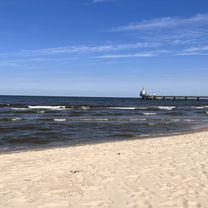
Tour zur Ostsee
A cycling route starting in Althüttendorf, Brandenburg, Germany.
Overview
null
created this 3 years ago
Part of
3 stages
Route quality
Quiet road
32.1 km
(35 %)
Track
15.6 km
(17 %)
Paved
73.4 km
(80 %)
Unpaved
2.8 km
(3 %)
Asphalt
65.1 km
(71 %)
Concrete
5.5 km
(6 %)
Continue with Bikemap
You would like to ride 2. Tag: Althüttendorf - Pasewalk or customize it for your own trip? Here is what you can do with this Bikemap route:
Free trial for 3 days, or one-time payment. More about Bikemap Premium.
Discover more Premium features.
Get Bikemap PremiumFrom our community
Open it in the app