

Boucle Gayeulles - La Mézière
A cycling route starting in Rennes, Brittany Region, France.
Overview
About this route
- -:--
- Duration
- 30.8 km
- Distance
- 201 m
- Ascent
- 201 m
- Descent
- ---
- Avg. speed
- 100 m
- Max. altitude

Route quality
Waytypes & surfaces along the route
Waytypes
Road
8 km
(26 %)
Cycleway
7.4 km
(24 %)
Surfaces
Paved
24.6 km
(80 %)
Unpaved
1.5 km
(5 %)
Asphalt
24.3 km
(79 %)
Gravel
1.2 km
(4 %)
Continue with Bikemap
Use, edit, or download this cycling route
You would like to ride Boucle Gayeulles - La Mézière or customize it for your own trip? Here is what you can do with this Bikemap route:
Free features
- Save this route as favorite or in collections
- Copy & plan your own version of this route
- Sync your route with Garmin or Wahoo
Premium features
Free trial for 3 days, or one-time payment. More about Bikemap Premium.
- Navigate this route on iOS & Android
- Export a GPX / KML file of this route
- Create your custom printout (try it for free)
- Download this route for offline navigation
Discover more Premium features.
Get Bikemap PremiumFrom our community
Other popular routes starting in Rennes
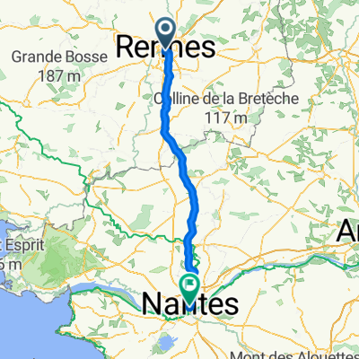 Von Rennes bis Nantes
- Distance
- 117 km
- Ascent
- 858 m
- Descent
- 888 m
- Location
- Rennes, Brittany Region, France
 Le Moulin Desgués
- Distance
- 12.9 km
- Ascent
- 75 m
- Descent
- 72 m
- Location
- Rennes, Brittany Region, France
 Itinéraire facile en Rennes
- Distance
- 12.3 km
- Ascent
- 291 m
- Descent
- 290 m
- Location
- Rennes, Brittany Region, France
 Tour de France 2015 - Stage 8
- Distance
- 190.6 km
- Ascent
- 1,011 m
- Descent
- 751 m
- Location
- Rennes, Brittany Region, France
 Bretagne Nord - Est (partie 1)
- Distance
- 149.6 km
- Ascent
- 220 m
- Descent
- 234 m
- Location
- Rennes, Brittany Region, France
 Rennes - Vitré (Google)
- Distance
- 37 km
- Ascent
- 261 m
- Descent
- 217 m
- Location
- Rennes, Brittany Region, France
 Bretagne Nord - Est (2014)
- Distance
- 278.5 km
- Ascent
- 604 m
- Descent
- 535 m
- Location
- Rennes, Brittany Region, France
 Rennes - Saint-Domineuc - St Malo
- Distance
- 74.9 km
- Ascent
- 268 m
- Descent
- 302 m
- Location
- Rennes, Brittany Region, France
Open it in the app