

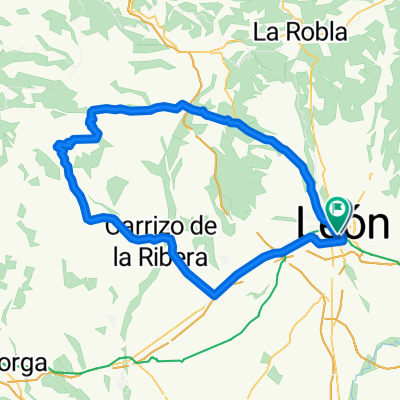
66 km. ruta de León, la hoja, Rioseco, Carrizo, Ferral, León
A cycling route starting in León, Castille and León, Spain.
Overview
About this route
- 3 h 34 min
- Duration
- 66.3 km
- Distance
- 515 m
- Ascent
- 565 m
- Descent
- 18.6 km/h
- Avg. speed
- 1,128 m
- Max. altitude

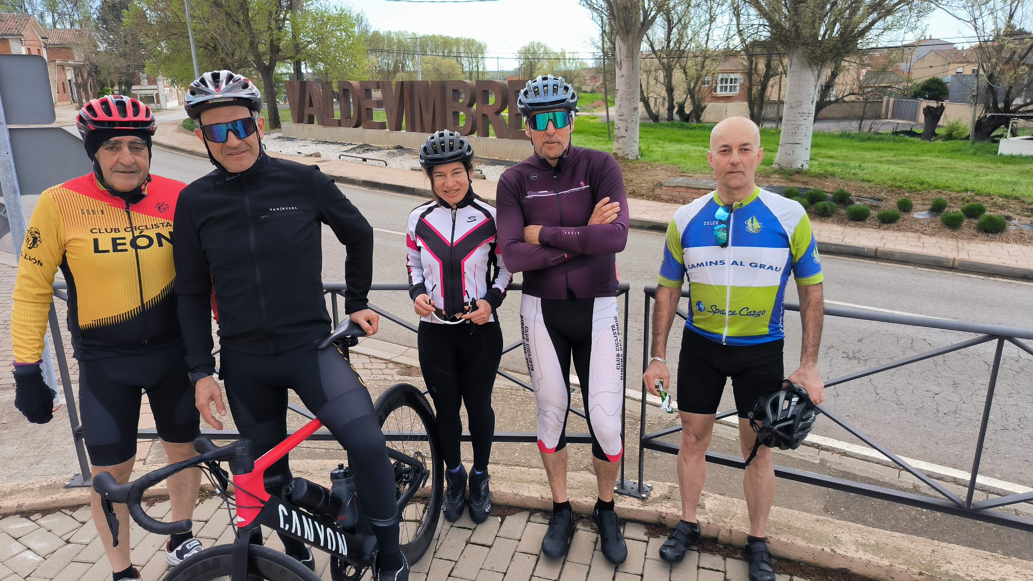
Route photos


Route quality
Waytypes & surfaces along the route
Waytypes
Road
4 km
(6 %)
Quiet road
3.3 km
(5 %)
Surfaces
Paved
61.7 km
(93 %)
Asphalt
61.7 km
(93 %)
Undefined
4.6 km
(7 %)
Continue with Bikemap
Use, edit, or download this cycling route
You would like to ride 66 km. ruta de León, la hoja, Rioseco, Carrizo, Ferral, León or customize it for your own trip? Here is what you can do with this Bikemap route:
Free features
- Save this route as favorite or in collections
- Copy & plan your own version of this route
- Sync your route with Garmin or Wahoo
Premium features
Free trial for 3 days, or one-time payment. More about Bikemap Premium.
- Navigate this route on iOS & Android
- Export a GPX / KML file of this route
- Create your custom printout (try it for free)
- Download this route for offline navigation
Discover more Premium features.
Get Bikemap PremiumFrom our community
Other popular routes starting in León
 León-Villaverde de arriba-León
- Distance
- 35.9 km
- Ascent
- 227 m
- Descent
- 227 m
- Location
- León, Castille and León, Spain
 76 km. ruta de Mansilla, Valdevimbre
- Distance
- 76.6 km
- Ascent
- 416 m
- Descent
- 466 m
- Location
- León, Castille and León, Spain
 LEON-LORENZANA-CUADROS-LA ROBLA-SANTA LUCIA-LA VID-VEGACERVERA-ROBLES-GARRAFE-LEON
- Distance
- 87.2 km
- Ascent
- 549 m
- Descent
- 532 m
- Location
- León, Castille and León, Spain
 León-Ribera del Torío-Riosequino-Venta de la Tuerta-León
- Distance
- 39.4 km
- Ascent
- 336 m
- Descent
- 337 m
- Location
- León, Castille and León, Spain
 León-Villaturiel-Villarroañe-León
- Distance
- 41.7 km
- Ascent
- 132 m
- Descent
- 132 m
- Location
- León, Castille and León, Spain
 Por el Bernesga y el Torío
- Distance
- 36.4 km
- Ascent
- 278 m
- Descent
- 278 m
- Location
- León, Castille and León, Spain
 SOBARRIBA (LEON-CORBILLOS-TENDAL-VILLAVENTE-VILLAFELIZ-REPRESA-S.CIPRIANO C.-S.VICENTE C.-CASTRILLO-VILLARENTE-LEON)
- Distance
- 52.2 km
- Ascent
- 292 m
- Descent
- 291 m
- Location
- León, Castille and León, Spain
 León-Villadangos-Carrizo-Riofrio-S.Feliz Lavanderas-Escuredo-Sta.Maria de Ordas-Rioseco Tapia-Alto 18-León
- Distance
- 97.2 km
- Ascent
- 836 m
- Descent
- 837 m
- Location
- León, Castille and León, Spain
Open it in the app