

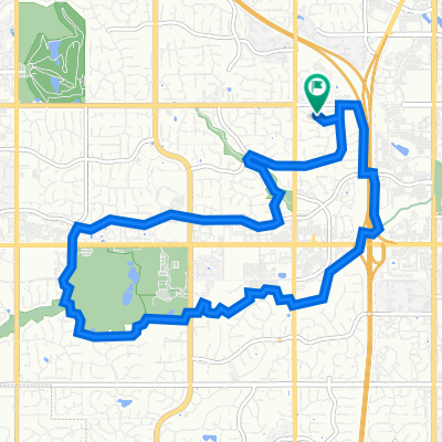
6822 W 132nd Terr, Overland Park to 6822 W 132nd Terr, Overland Park
A cycling route starting in Lenexa, Kansas, United States.
Overview
About this route
- 2 h 11 min
- Duration
- 39.8 km
- Distance
- 282 m
- Ascent
- 282 m
- Descent
- 18.2 km/h
- Avg. speed
- 328 m
- Max. altitude

Route quality
Waytypes & surfaces along the route
Waytypes
Cycleway
27.4 km
(69 %)
Pedestrian area
3.6 km
(9 %)
Surfaces
Paved
29.4 km
(74 %)
Asphalt
21.5 km
(54 %)
Paved (undefined)
7.2 km
(18 %)
Continue with Bikemap
Use, edit, or download this cycling route
You would like to ride 6822 W 132nd Terr, Overland Park to 6822 W 132nd Terr, Overland Park or customize it for your own trip? Here is what you can do with this Bikemap route:
Free features
- Save this route as favorite or in collections
- Copy & plan your own version of this route
- Sync your route with Garmin or Wahoo
Premium features
Free trial for 3 days, or one-time payment. More about Bikemap Premium.
- Navigate this route on iOS & Android
- Export a GPX / KML file of this route
- Create your custom printout (try it for free)
- Download this route for offline navigation
Discover more Premium features.
Get Bikemap PremiumFrom our community
Other popular routes starting in Lenexa
 Pinnacle to Olathe Lake to Pinnacle- R1
- Distance
- 38.2 km
- Ascent
- 228 m
- Descent
- 228 m
- Location
- Lenexa, Kansas, United States
 shawnee mission park
- Distance
- 7.1 km
- Ascent
- 104 m
- Descent
- 104 m
- Location
- Lenexa, Kansas, United States
 Tomahawk Trail West Loop
- Distance
- 14.1 km
- Ascent
- 114 m
- Descent
- 114 m
- Location
- Lenexa, Kansas, United States
 Modified Bike Source Ride
- Distance
- 62 km
- Ascent
- 191 m
- Descent
- 184 m
- Location
- Lenexa, Kansas, United States
 9305 Moody Park Dr, Overland Park to 9305 Moody Park Dr, Overland Park
- Distance
- 10.2 km
- Ascent
- 71 m
- Descent
- 76 m
- Location
- Lenexa, Kansas, United States
 17.95 mi starting at Woodland park
- Distance
- 29.9 km
- Ascent
- 179 m
- Descent
- 180 m
- Location
- Lenexa, Kansas, United States
 9305 Moody Park Dr, Overland Park to 9305 Moody Park Dr, Overland Park
- Distance
- 10.4 km
- Ascent
- 86 m
- Descent
- 88 m
- Location
- Lenexa, Kansas, United States
 6822 W 132nd Terr, Overland Park to 6822 W 132nd Terr, Overland Park
- Distance
- 39.8 km
- Ascent
- 282 m
- Descent
- 282 m
- Location
- Lenexa, Kansas, United States
Open it in the app