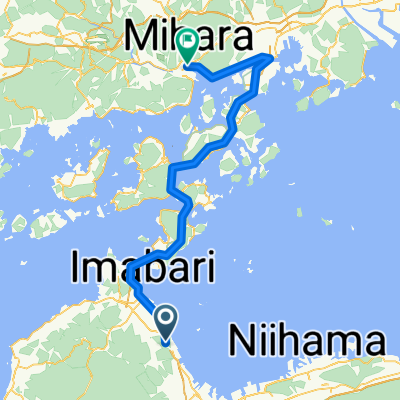
Plan Day 1 Saijo to Onomichi
A cycling route starting in Saijō, Ehime, Japan.
Overview
About this route
- -:--
- Duration
- 93.6 km
- Distance
- 1,020 m
- Ascent
- 920 m
- Descent
- ---
- Avg. speed
- 108 m
- Max. altitude
Route quality
Waytypes & surfaces along the route
Waytypes
Quiet road
32.8 km
(35 %)
Cycleway
30.2 km
(32 %)
Surfaces
Paved
15.2 km
(16 %)
Paved (undefined)
9.4 km
(10 %)
Asphalt
5.8 km
(6 %)
Undefined
78.5 km
(84 %)
Route highlights
Points of interest along the route
Point of interest after 35.1 km
Continue with Bikemap
Use, edit, or download this cycling route
You would like to ride Plan Day 1 Saijo to Onomichi or customize it for your own trip? Here is what you can do with this Bikemap route:
Free features
- Save this route as favorite or in collections
- Copy & plan your own version of this route
- Split it into stages to create a multi-day tour
- Sync your route with Garmin or Wahoo
Premium features
Free trial for 3 days, or one-time payment. More about Bikemap Premium.
- Navigate this route on iOS & Android
- Export a GPX / KML file of this route
- Create your custom printout (try it for free)
- Download this route for offline navigation
Discover more Premium features.
Get Bikemap PremiumFrom our community
Other popular routes starting in Saijō
- Second part of cycling
- Distance
- 9.6 km
- Ascent
- 485 m
- Descent
- 324 m
- Location
- Saijō, Ehime, Japan
- Toyo Port to Kan-onji
- Distance
- 73.6 km
- Ascent
- 819 m
- Descent
- 818 m
- Location
- Saijō, Ehime, Japan
- Tokyo to Shikoku
- Distance
- 1,054.6 km
- Ascent
- 10,883 m
- Descent
- 10,842 m
- Location
- Saijō, Ehime, Japan
- Semento 3
- Distance
- 49.5 km
- Ascent
- 678 m
- Descent
- 390 m
- Location
- Saijō, Ehime, Japan
- Plan Day 1 Saijo to Onomichi
- Distance
- 93.6 km
- Ascent
- 1,020 m
- Descent
- 920 m
- Location
- Saijō, Ehime, Japan
- Third part of cycling
- Distance
- 15.4 km
- Ascent
- 532 m
- Descent
- 1,052 m
- Location
- Saijō, Ehime, Japan
- Chikoku
- Distance
- 129.4 km
- Ascent
- 522 m
- Descent
- 518 m
- Location
- Saijō, Ehime, Japan
- 黒森峠・瓶ヶ森林道
- Distance
- 144.3 km
- Ascent
- 2,575 m
- Descent
- 2,576 m
- Location
- Saijō, Ehime, Japan
Open it in the app