esterel4
- 28.5 km
- 429 m
- 429 m
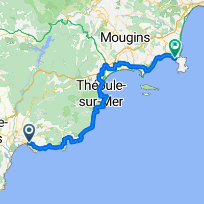
- Saint-Raphaël, Provence-Alpes-Côte d'Azur Region, France
A cycling route starting in Saint-Raphaël, Provence-Alpes-Côte d'Azur Region, France.
Overview
Extremely varied tour with a quiet hinterland, challenging climbs, and sea views. The panorama from Tanneron towards Cannes is very beautiful. Many bikers meet up there.
created this 16 years ago
Route quality
Road
28 km
(33 %)
Quiet road
5.1 km
(6 %)
Paved
47.5 km
(56 %)
Unpaved
2.5 km
(3 %)
Asphalt
47.5 km
(56 %)
Ground
1.7 km
(2 %)
Continue with Bikemap
You would like to ride Von Boulouris über Tanneron über die Corniche zurück or customize it for your own trip? Here is what you can do with this Bikemap route:
Free trial for 3 days, or one-time payment. More about Bikemap Premium.
Discover more Premium features.
Get Bikemap PremiumFrom our community
Open it in the app