

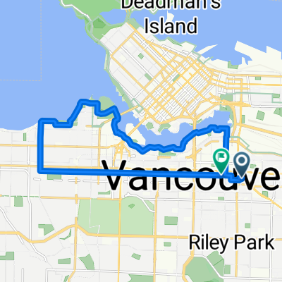
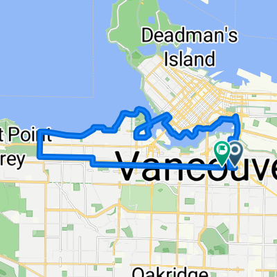
UBC Faslse Creek
A cycling route starting in Vancouver, British Columbia, Canada.
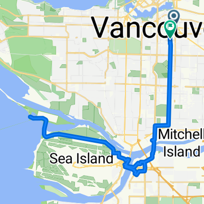
Overview
About this route
Home UBC Spanish Bank Burrard Bridge False Creek Ontraio St Home
- -:--
- Duration
- 40 km
- Distance
- 384 m
- Ascent
- 384 m
- Descent
- ---
- Avg. speed
- 101 m
- Max. altitude

Route quality
Waytypes & surfaces along the route
Waytypes
Quiet road
20 km
(50 %)
Road
7.6 km
(19 %)
Surfaces
Paved
36.4 km
(91 %)
Asphalt
35.6 km
(89 %)
Paved (undefined)
0.8 km
(2 %)
Undefined
3.6 km
(9 %)
Continue with Bikemap
Use, edit, or download this cycling route
You would like to ride UBC Faslse Creek or customize it for your own trip? Here is what you can do with this Bikemap route:
Free features
- Save this route as favorite or in collections
- Copy & plan your own version of this route
- Sync your route with Garmin or Wahoo
Premium features
Free trial for 3 days, or one-time payment. More about Bikemap Premium.
- Navigate this route on iOS & Android
- Export a GPX / KML file of this route
- Create your custom printout (try it for free)
- Download this route for offline navigation
Discover more Premium features.
Get Bikemap PremiumFrom our community
Other popular routes starting in Vancouver
 49.248, -123.150 to 49.243, -123.153
- Distance
- 26.8 km
- Ascent
- 217 m
- Descent
- 233 m
- Location
- Vancouver, British Columbia, Canada
 bike tour through Vancouver
- Distance
- 29.9 km
- Ascent
- 306 m
- Descent
- 307 m
- Location
- Vancouver, British Columbia, Canada
 West 17th Avenue 2069, Vancouver to Stanley Park Drive 8501, Vancouver
- Distance
- 16.2 km
- Ascent
- 42 m
- Descent
- 78 m
- Location
- Vancouver, British Columbia, Canada
 West 17th Avenue 2051, Vancouver to West 17th Avenue 2069, Vancouver
- Distance
- 18.7 km
- Ascent
- 129 m
- Descent
- 129 m
- Location
- Vancouver, British Columbia, Canada
 233 E 11th Ave, Vancouver to 2458 Point Grey Rd, Vancouver
- Distance
- 13.4 km
- Ascent
- 119 m
- Descent
- 121 m
- Location
- Vancouver, British Columbia, Canada
 Loop: False Creek + South English Bay + 10th Ave
- Distance
- 19.5 km
- Ascent
- 208 m
- Descent
- 208 m
- Location
- Vancouver, British Columbia, Canada
 Easy ride in Vancouver
- Distance
- 55.1 km
- Ascent
- 202 m
- Descent
- 290 m
- Location
- Vancouver, British Columbia, Canada
 GBM - Iona Island (37 km)
- Distance
- 37.5 km
- Ascent
- 183 m
- Descent
- 175 m
- Location
- Vancouver, British Columbia, Canada
Open it in the app