

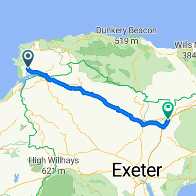
windfarm loop
A cycling route starting in Braunton, England, United Kingdom.
Overview
About this route
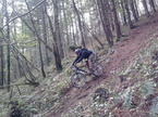
hills up,hills down , mad farmers , mud up hill mud downhill , stingers, cowshit and rocks thos route was great fun chatting with a farmer we couldn't understand then being chased by livestock. a good rewarding ride. only thing missing was a pint at the end(down to no money,but the aggi is on the way back into the village)
- -:--
- Duration
- 14.8 km
- Distance
- 265 m
- Ascent
- 262 m
- Descent
- ---
- Avg. speed
- ---
- Max. altitude
Continue with Bikemap
Use, edit, or download this cycling route
You would like to ride windfarm loop or customize it for your own trip? Here is what you can do with this Bikemap route:
Free features
- Save this route as favorite or in collections
- Copy & plan your own version of this route
- Sync your route with Garmin or Wahoo
Premium features
Free trial for 3 days, or one-time payment. More about Bikemap Premium.
- Navigate this route on iOS & Android
- Export a GPX / KML file of this route
- Create your custom printout (try it for free)
- Download this route for offline navigation
Discover more Premium features.
Get Bikemap PremiumFrom our community
Other popular routes starting in Braunton
 oz mans xc route
- Distance
- 17.2 km
- Ascent
- 142 m
- Descent
- 144 m
- Location
- Braunton, England, United Kingdom
 windfarm loop
- Distance
- 14.8 km
- Ascent
- 265 m
- Descent
- 262 m
- Location
- Braunton, England, United Kingdom
 braunton to m5
- Distance
- 71.1 km
- Ascent
- 609 m
- Descent
- 528 m
- Location
- Braunton, England, United Kingdom
 1 st ride out
- Distance
- 18.9 km
- Ascent
- 55 m
- Descent
- 55 m
- Location
- Braunton, England, United Kingdom
 Tarka Trail
- Distance
- 48.7 km
- Ascent
- 233 m
- Descent
- 152 m
- Location
- Braunton, England, United Kingdom
 slack jaw
- Distance
- 20.6 km
- Ascent
- 318 m
- Descent
- 318 m
- Location
- Braunton, England, United Kingdom
 pint
pint- Distance
- 14.5 km
- Ascent
- 200 m
- Descent
- 199 m
- Location
- Braunton, England, United Kingdom
 braunton-trail centre
- Distance
- 12.7 km
- Ascent
- 288 m
- Descent
- 124 m
- Location
- Braunton, England, United Kingdom
Open it in the app