

Muotathal - Uznach - Küsnacht
A cycling route starting in Muotathal, Canton of Schwyz, Switzerland.
Overview
About this route
<p>null</p>
Translated, show original (German)- -:--
- Duration
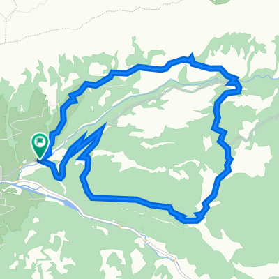
- 97.1 km
- Distance
- 1,430 m
- Ascent
- 1,604 m
- Descent
- ---
- Avg. speed
- 1,567 m
- Max. altitude

Route photos


Route quality
Waytypes & surfaces along the route
Waytypes
Quiet road
35.9 km
(37 %)
Road
33 km
(34 %)
Surfaces
Paved
83.5 km
(86 %)
Unpaved
4.9 km
(5 %)
Asphalt
83.5 km
(86 %)
Gravel
4.9 km
(5 %)
Undefined
8.7 km
(9 %)
Continue with Bikemap
Use, edit, or download this cycling route
You would like to ride Muotathal - Uznach - Küsnacht or customize it for your own trip? Here is what you can do with this Bikemap route:
Free features
- Save this route as favorite or in collections
- Copy & plan your own version of this route
- Split it into stages to create a multi-day tour
- Sync your route with Garmin or Wahoo
Premium features
Free trial for 3 days, or one-time payment. More about Bikemap Premium.
- Navigate this route on iOS & Android
- Export a GPX / KML file of this route
- Create your custom printout (try it for free)
- Download this route for offline navigation
Discover more Premium features.
Get Bikemap PremiumFrom our community
Other popular routes starting in Muotathal
 Pragelpass_Klausenpass (ironm)
- Distance
- 67.7 km
- Ascent
- 1,797 m
- Descent
- 1,388 m
- Location
- Muotathal, Canton of Schwyz, Switzerland
 WanderWunder Schwyz: Rundwanderung Muotathal mit Plattenweg
- Distance
- 13.3 km
- Ascent
- 1,033 m
- Descent
- 1,031 m
- Location
- Muotathal, Canton of Schwyz, Switzerland
 Einsiedeln-Ibergeregg-Pragel-Schwialppass-Sattelegg
- Distance
- 74.4 km
- Ascent
- 2,266 m
- Descent
- 2,264 m
- Location
- Muotathal, Canton of Schwyz, Switzerland
 Klausenpass Rückfahrt
- Distance
- 166.7 km
- Ascent
- 1,495 m
- Descent
- 2,929 m
- Location
- Muotathal, Canton of Schwyz, Switzerland
 W/Muotathal gross
- Distance
- 17.4 km
- Ascent
- 843 m
- Descent
- 791 m
- Location
- Muotathal, Canton of Schwyz, Switzerland
 Muotathal-Weesen
- Distance
- 48.3 km
- Ascent
- 941 m
- Descent
- 1,181 m
- Location
- Muotathal, Canton of Schwyz, Switzerland
 Route im Schneckentempo in Glarus
- Distance
- 18.9 km
- Ascent
- 69 m
- Descent
- 1,109 m
- Location
- Muotathal, Canton of Schwyz, Switzerland
 Muotathal Chinzig Dottenriet
- Distance
- 60.7 km
- Ascent
- 2,014 m
- Descent
- 2,435 m
- Location
- Muotathal, Canton of Schwyz, Switzerland
Open it in the app