

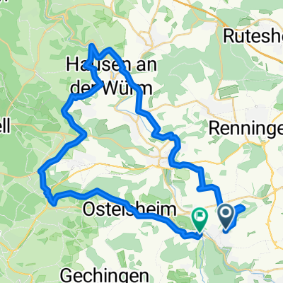
RTF Magstadt, Route B, 111km, Jahr 2011
A cycling route starting in Magstadt, Baden-Württemberg, Germany.
Overview
About this route
RTF Magstadt, Route B, 111km, Jahr 2011,
Angegeben mit 1500 Hm
- -:--
- Duration
- 106.5 km
- Distance
- 1,108 m
- Ascent
- 1,108 m
- Descent
- ---
- Avg. speed
- ---
- Max. altitude
Route quality
Waytypes & surfaces along the route
Waytypes
Busy road
43.7 km
(41 %)
Road
41.7 km
(39 %)
Surfaces
Paved
92.1 km
(86 %)
Unpaved
2.3 km
(2 %)
Asphalt
87 km
(82 %)
Paved (undefined)
3.9 km
(4 %)
Continue with Bikemap
Use, edit, or download this cycling route
You would like to ride RTF Magstadt, Route B, 111km, Jahr 2011 or customize it for your own trip? Here is what you can do with this Bikemap route:
Free features
- Save this route as favorite or in collections
- Copy & plan your own version of this route
- Split it into stages to create a multi-day tour
- Sync your route with Garmin or Wahoo
Premium features
Free trial for 3 days, or one-time payment. More about Bikemap Premium.
- Navigate this route on iOS & Android
- Export a GPX / KML file of this route
- Create your custom printout (try it for free)
- Download this route for offline navigation
Discover more Premium features.
Get Bikemap PremiumFrom our community
Other popular routes starting in Magstadt
 Querfeldein durch's Heckengäu
- Distance
- 40.4 km
- Ascent
- 604 m
- Descent
- 626 m
- Location
- Magstadt, Baden-Württemberg, Germany
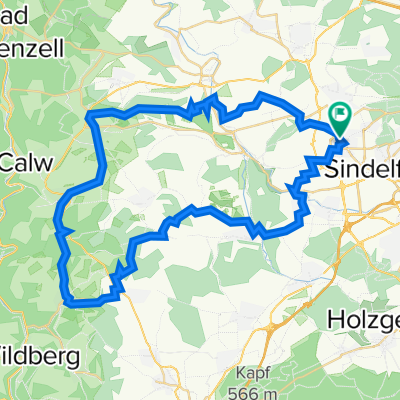
 RTF Magstadt
- Distance
- 105.6 km
- Ascent
- 1,497 m
- Descent
- 1,531 m
- Location
- Magstadt, Baden-Württemberg, Germany
 Von Maichingen an die Schwarzwaldgrenze
- Distance
- 54.7 km
- Ascent
- 733 m
- Descent
- 733 m
- Location
- Magstadt, Baden-Württemberg, Germany
 Schönbuch-Heckengäu-Tour
- Distance
- 60.3 km
- Ascent
- 646 m
- Descent
- 646 m
- Location
- Magstadt, Baden-Württemberg, Germany
 Siebenmühlental
- Distance
- 47.3 km
- Ascent
- 369 m
- Descent
- 367 m
- Location
- Magstadt, Baden-Württemberg, Germany
 Sindelfingen - Bietigheim-Bissingen (den neckar entlang)
- Distance
- 63.7 km
- Ascent
- 373 m
- Descent
- 612 m
- Location
- Magstadt, Baden-Württemberg, Germany
 ohne plan ne Runde
- Distance
- 28 km
- Ascent
- 482 m
- Descent
- 499 m
- Location
- Magstadt, Baden-Württemberg, Germany
 32KM Rundtour über Ehningen und Böblingen
- Distance
- 31.7 km
- Ascent
- 258 m
- Descent
- 258 m
- Location
- Magstadt, Baden-Württemberg, Germany
Open it in the app