

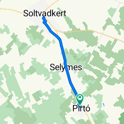
Dózsa György utca 17, Pirtó - Zrínyi utca 28, Kiskunhalas
A cycling route starting in Tázlár, Bács-Kiskun county, Hungary.
Overview
About this route
- 1 h 17 min
- Duration
- 10.1 km
- Distance
- 73 m
- Ascent
- 63 m
- Descent
- 7.8 km/h
- Avg. speed
- 135 m
- Max. altitude

Route quality
Waytypes & surfaces along the route
Waytypes
Cycleway
6.9 km
(68 %)
Path
1.2 km
(12 %)
Surfaces
Paved
7.6 km
(75 %)
Asphalt
7.5 km
(74 %)
Wood
0.1 km
(<1 %)
Undefined
2.6 km
(25 %)
Continue with Bikemap
Use, edit, or download this cycling route
You would like to ride Dózsa György utca 17, Pirtó - Zrínyi utca 28, Kiskunhalas or customize it for your own trip? Here is what you can do with this Bikemap route:
Free features
- Save this route as favorite or in collections
- Copy & plan your own version of this route
- Sync your route with Garmin or Wahoo
Premium features
Free trial for 3 days, or one-time payment. More about Bikemap Premium.
- Navigate this route on iOS & Android
- Export a GPX / KML file of this route
- Create your custom printout (try it for free)
- Download this route for offline navigation
Discover more Premium features.
Get Bikemap PremiumFrom our community
Other popular routes starting in Tázlár
 Easy ride in Vadkertitó
- Distance
- 13.8 km
- Ascent
- 242 m
- Descent
- 241 m
- Location
- Tázlár, Bács-Kiskun county, Hungary
 Bócsa helyi hálózat
- Distance
- 3.9 km
- Ascent
- 0 m
- Descent
- 0 m
- Location
- Tázlár, Bács-Kiskun county, Hungary
 Új utca - Új utca
- Distance
- 16.8 km
- Ascent
- 24 m
- Descent
- 69 m
- Location
- Tázlár, Bács-Kiskun county, Hungary
 Pirtó helyi hálózat
- Distance
- 4.1 km
- Ascent
- 0 m
- Descent
- 4 m
- Location
- Tázlár, Bács-Kiskun county, Hungary
 pirtó
pirtó- Distance
- 9.5 km
- Ascent
- 301 m
- Descent
- 280 m
- Location
- Tázlár, Bács-Kiskun county, Hungary
 kiskunhalas
- Distance
- 10.1 km
- Ascent
- 61 m
- Descent
- 65 m
- Location
- Tázlár, Bács-Kiskun county, Hungary
 Tázlár helyi hálózat
- Distance
- 3.3 km
- Ascent
- 3 m
- Descent
- 4 m
- Location
- Tázlár, Bács-Kiskun county, Hungary
 Tázlár-Kalocsa-Mözs (4/2 etap)
- Distance
- 77.3 km
- Ascent
- 18 m
- Descent
- 39 m
- Location
- Tázlár, Bács-Kiskun county, Hungary
Open it in the app