Mma granic臋 i pod d膮b Bartek
A cycling route starting in Stalowa Wola, Subcarpathian Voivodeship, Poland.
Overview
About this route
- -:--
- Duration
- 48.9 km
- Distance
- 82 m
- Ascent
- 81 m
- Descent
- ---
- Avg. speed
- 196 m
- Avg. speed
Continue with Bikemap
Use, edit, or download this cycling route
You would like to ride Mma granic臋 i pod d膮b Bartek or customize it for your own trip? Here is what you can do with this Bikemap route:
Free features
- Save this route as favorite or in collections
- Copy & plan your own version of this route
- Sync your route with Garmin or Wahoo
Premium features
Free trial for 3 days, or one-time payment. More about Bikemap Premium.
- Navigate this route on iOS & Android
- Export a GPX / KML file of this route
- Create your custom printout (try it for free)
- Download this route for offline navigation
Discover more Premium features.
Get Bikemap PremiumFrom our community
Other popular routes starting in Stalowa Wola
- Rowerowa trasa do PxM 2011/2012
- Distance
- 44.8 km
- Ascent
- 57 m
- Descent
- 57 m
- Location
- Stalowa Wola, Subcarpathian Voivodeship, Poland
- Chwilowo nie pada wi臋c jad臋 na grzyby
- Distance
- 19.9 km
- Ascent
- 67 m
- Descent
- 67 m
- Location
- Stalowa Wola, Subcarpathian Voivodeship, Poland
- Aleje Jana Paw艂a II 13A, Stalowa Wola do Aleje Jana Paw艂a II 13A, Stalowa Wola
- Distance
- 9.5 km
- Ascent
- 36 m
- Descent
- 35 m
- Location
- Stalowa Wola, Subcarpathian Voivodeship, Poland
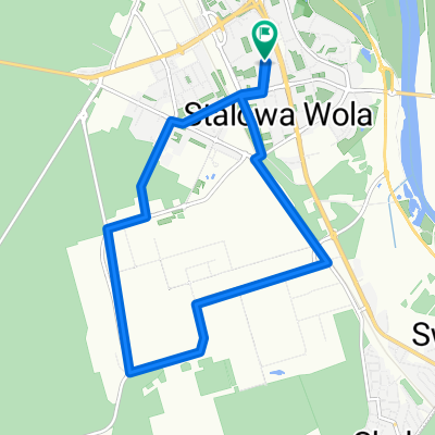
- Lengthy bike tour from 15 sierpnia, 10:03
- Distance
- 49.3 km
- Ascent
- 94 m
- Descent
- 96 m
- Location
- Stalowa Wola, Subcarpathian Voivodeship, Poland
- 艁膮cznik Greenvelo przez Lasy Pa艅stwowe
- Distance
- 12.7 km
- Ascent
- 33 m
- Descent
- 30 m
- Location
- Stalowa Wola, Subcarpathian Voivodeship, Poland
- Lasem Lipskim na je偶yny
- Distance
- 50.8 km
- Ascent
- 215 m
- Descent
- 217 m
- Location
- Stalowa Wola, Subcarpathian Voivodeship, Poland
- Kr贸tki trip po lesie
- Distance
- 55.3 km
- Ascent
- 177 m
- Descent
- 177 m
- Location
- Stalowa Wola, Subcarpathian Voivodeship, Poland
- BIKE.TOUR.2014 ROZTOCZE
- Distance
- 236.3 km
- Ascent
- 329 m
- Descent
- 323 m
- Location
- Stalowa Wola, Subcarpathian Voivodeship, Poland
Open it in the app