

78/28 Soi Intharakhiri, Mae Sot to ตก. 07022, Mae Sot
A cycling route starting in Mae Sot, Tak, Thailand.
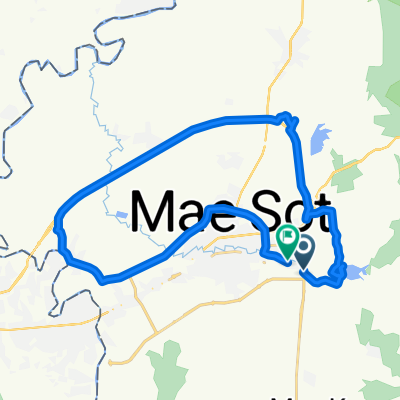
Overview
About this route
- 33 min
- Duration
- 9.9 km
- Distance
- 9 m
- Ascent
- 25 m
- Descent
- 18.1 km/h
- Avg. speed
- 219 m
- Max. altitude
Route quality
Waytypes & surfaces along the route
Waytypes
Quiet road
0.3 km
(3 %)
Undefined
9.6 km
(97 %)
Continue with Bikemap
Use, edit, or download this cycling route
You would like to ride 78/28 Soi Intharakhiri, Mae Sot to ตก. 07022, Mae Sot or customize it for your own trip? Here is what you can do with this Bikemap route:
Free features
- Save this route as favorite or in collections
- Copy & plan your own version of this route
- Sync your route with Garmin or Wahoo
Premium features
Free trial for 3 days, or one-time payment. More about Bikemap Premium.
- Navigate this route on iOS & Android
- Export a GPX / KML file of this route
- Create your custom printout (try it for free)
- Download this route for offline navigation
Discover more Premium features.
Get Bikemap PremiumFrom our community
Other popular routes starting in Mae Sot
 ThailandTakMae Sot to ThailandTakMae Sot
- Distance
- 14 km
- Ascent
- 107 m
- Descent
- 77 m
- Location
- Mae Sot, Tak, Thailand
 1T06 Tak
- Distance
- 87.6 km
- Ascent
- 1,144 m
- Descent
- 1,247 m
- Location
- Mae Sot, Tak, Thailand
 Mae Sot to Mae Sot
- Distance
- 40 km
- Ascent
- 185 m
- Descent
- 192 m
- Location
- Mae Sot, Tak, Thailand
 ThailandTakMae Sot to ThailandTakMae Sot
- Distance
- 14.6 km
- Ascent
- 122 m
- Descent
- 104 m
- Location
- Mae Sot, Tak, Thailand
 Easy ride
- Distance
- 14.6 km
- Ascent
- 141 m
- Descent
- 122 m
- Location
- Mae Sot, Tak, Thailand
 ThailandTakMae Sot to ThailandTakMae Sot
- Distance
- 21.7 km
- Ascent
- 151 m
- Descent
- 114 m
- Location
- Mae Sot, Tak, Thailand
 ThailandTakMae Sot to ThailandTakMae Sot
- Distance
- 26.4 km
- Ascent
- 212 m
- Descent
- 209 m
- Location
- Mae Sot, Tak, Thailand
 ThailandTakMae Sot to ThailandTakMae Sot
- Distance
- 14.7 km
- Ascent
- 156 m
- Descent
- 117 m
- Location
- Mae Sot, Tak, Thailand
Open it in the app