
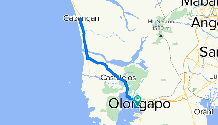
Audax Populaire 100KM
A cycling route starting in Olongapo City, Central Luzon, Philippines.
Overview
About this route
- -:--
- Duration
- 105.7 km
- Distance
- 523 m
- Ascent
- 524 m
- Descent
- ---
- Avg. speed
- 60 m
- Max. altitude

Continue with Bikemap
Use, edit, or download this cycling route
You would like to ride Audax Populaire 100KM or customize it for your own trip? Here is what you can do with this Bikemap route:
Free features
- Save this route as favorite or in collections
- Copy & plan your own version of this route
- Split it into stages to create a multi-day tour
- Sync your route with Garmin or Wahoo
Premium features
Free trial for 3 days, or one-time payment. More about Bikemap Premium.
- Navigate this route on iOS & Android
- Export a GPX / KML file of this route
- Create your custom printout (try it for free)
- Download this route for offline navigation
Discover more Premium features.
Get Bikemap PremiumFrom our community
Other popular routes starting in Olongapo City
 on road to bike
- Distance
- 0.3 km
- Ascent
- 16 m
- Descent
- 4 m
- Location
- Olongapo City, Central Luzon, Philippines
 Santa Rita Street 1101, Olongapo to Binictican Drive, Subic Bay Freeport Zone
- Distance
- 10.7 km
- Ascent
- 64 m
- Descent
- 35 m
- Location
- Olongapo City, Central Luzon, Philippines
 40 km ride SRF to SRF Subic Olongapo
- Distance
- 40.7 km
- Ascent
- 466 m
- Descent
- 464 m
- Location
- Olongapo City, Central Luzon, Philippines
 Naval Air Station Cubi Point, Subic Bay Freeport Zone to Olongapo - Bugallon Road 14
- Distance
- 10.8 km
- Ascent
- 220 m
- Descent
- 146 m
- Location
- Olongapo City, Central Luzon, Philippines
 Dinalupihan to Dinalupihan
- Distance
- 88.5 km
- Ascent
- 694 m
- Descent
- 694 m
- Location
- Olongapo City, Central Luzon, Philippines
 Route to Fendler Street, Olongapo City
- Distance
- 13 km
- Ascent
- 43 m
- Descent
- 40 m
- Location
- Olongapo City, Central Luzon, Philippines
 Palm Street, Olongapo to Old Cabalan, Olongapo
- Distance
- 7.2 km
- Ascent
- 43 m
- Descent
- 20 m
- Location
- Olongapo City, Central Luzon, Philippines
 Argonaut Highway, Olongapo to Finback East, Olongapo
- Distance
- 9.7 km
- Ascent
- 226 m
- Descent
- 136 m
- Location
- Olongapo City, Central Luzon, Philippines
Open it in the app