

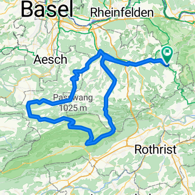
Passwang - Unt. Hauenstein
- 113.1 km
- 1,210 m
- 1,204 m
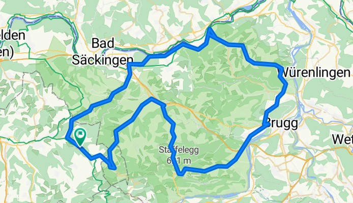
- Ormalingen, Basel-Landschaft, Switzerland
A cycling route starting in Ormalingen, Basel-Landschaft, Switzerland.
Overview
Flat access via Fricktal to Manacherhöhe (beautiful gently ascending mountain road) with 3-4 hairpin bends. Continue through the Aargau wine region (Schinznach-Dorf recommended for wine connoisseurs).
Slightly hilly approach to Staffelegg and return via Frick with a detour via Kienberg (SO) into the beautiful Oberbaselbiet.
created this 14 years ago
Route quality
Road
24.6 km
(28 %)
Quiet road
8.8 km
(10 %)
Paved
62.3 km
(71 %)
Unpaved
4.4 km
(5 %)
Asphalt
56.2 km
(64 %)
Paved (undefined)
6.1 km
(7 %)
Continue with Bikemap
You would like to ride 1. August-Tour Mandacherhöhe or customize it for your own trip? Here is what you can do with this Bikemap route:
Free trial for 3 days, or one-time payment. More about Bikemap Premium.
Discover more Premium features.
Get Bikemap PremiumFrom our community
Open it in the app


