

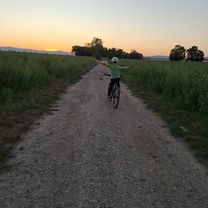
Легкая езда
A cycling route starting in Trnava, Trnava Region, Slovakia.
Overview
About this route
- 39 min
- Duration
- 9.6 km
- Distance
- 57 m
- Ascent
- 120 m
- Descent
- 14.9 km/h
- Avg. speed
- 197 m
- Max. altitude

Route quality
Waytypes & surfaces along the route
Waytypes
Cycleway
5.4 km
(56 %)
Pedestrian area
2.2 km
(23 %)
Surfaces
Paved
6.5 km
(68 %)
Asphalt
6.5 km
(68 %)
Undefined
3.1 km
(32 %)
Continue with Bikemap
Use, edit, or download this cycling route
You would like to ride Легкая езда or customize it for your own trip? Here is what you can do with this Bikemap route:
Free features
- Save this route as favorite or in collections
- Copy & plan your own version of this route
- Sync your route with Garmin or Wahoo
Premium features
Free trial for 3 days, or one-time payment. More about Bikemap Premium.
- Navigate this route on iOS & Android
- Export a GPX / KML file of this route
- Create your custom printout (try it for free)
- Download this route for offline navigation
Discover more Premium features.
Get Bikemap PremiumFrom our community
Other popular routes starting in Trnava
 Trnavská do M. R. Štefánika
- Distance
- 11.5 km
- Ascent
- 15 m
- Descent
- 60 m
- Location
- Trnava, Trnava Region, Slovakia
 Školská, Šúrovce až Školská, Šúrovce
- Distance
- 58.2 km
- Ascent
- 279 m
- Descent
- 279 m
- Location
- Trnava, Trnava Region, Slovakia
 Trnava - Bradlo - Jablonica
- Distance
- 63.4 km
- Ascent
- 828 m
- Descent
- 759 m
- Location
- Trnava, Trnava Region, Slovakia
 M. R. Štefánika do M. R. Štefánika
- Distance
- 10 km
- Ascent
- 18 m
- Descent
- 65 m
- Location
- Trnava, Trnava Region, Slovakia
 Trnavsko-nitriansky okruh
- Distance
- 120.5 km
- Ascent
- 289 m
- Descent
- 274 m
- Location
- Trnava, Trnava Region, Slovakia
 TT-50
TT-50- Distance
- 56.5 km
- Ascent
- 419 m
- Descent
- 416 m
- Location
- Trnava, Trnava Region, Slovakia
 Stredná trasa Častá
- Distance
- 25.5 km
- Ascent
- 263 m
- Descent
- 144 m
- Location
- Trnava, Trnava Region, Slovakia
 Trnava - Zavar - Šúrovce - Siladice
- Distance
- 37.6 km
- Ascent
- 61 m
- Descent
- 60 m
- Location
- Trnava, Trnava Region, Slovakia
Open it in the app