
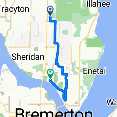
69 NE Mulberry Ln, Bremerton to 69 NE Mulberry Ln, Bremerton
A cycling route starting in Tracyton, Washington, United States of America.
Overview
About this route
- 26 min
- Duration
- 8.5 km
- Distance
- 119 m
- Ascent
- 82 m
- Descent
- 19.9 km/h
- Avg. speed
- 85 m
- Max. altitude
Route quality
Waytypes & surfaces along the route
Waytypes
Quiet road
8.5 km
(100 %)
Surfaces
Paved
1.6 km
(18 %)
Asphalt
1.6 km
(18 %)
Undefined
6.9 km
(82 %)
Continue with Bikemap
Use, edit, or download this cycling route
You would like to ride 69 NE Mulberry Ln, Bremerton to 69 NE Mulberry Ln, Bremerton or customize it for your own trip? Here is what you can do with this Bikemap route:
Free features
- Save this route as favorite or in collections
- Copy & plan your own version of this route
- Sync your route with Garmin or Wahoo
Premium features
Free trial for 3 days, or one-time payment. More about Bikemap Premium.
- Navigate this route on iOS & Android
- Export a GPX / KML file of this route
- Create your custom printout (try it for free)
- Download this route for offline navigation
Discover more Premium features.
Get Bikemap PremiumFrom our community
Other popular routes starting in Tracyton
 Sol Duc Drive Northeast 6259, Bremerton to Alexis Drive Northeast 6254, Bremerton
- Distance
- 36.5 km
- Ascent
- 451 m
- Descent
- 435 m
- Location
- Tracyton, Washington, United States of America
 Central Valley Ride
- Distance
- 27.4 km
- Ascent
- 342 m
- Descent
- 339 m
- Location
- Tracyton, Washington, United States of America
 Test Route
- Distance
- 5.1 km
- Ascent
- 102 m
- Descent
- 195 m
- Location
- Tracyton, Washington, United States of America
 5050 State Highway 303 NE, Bremerton to 2400–2446 Cherry Ave, Bremerton
- Distance
- 6.5 km
- Ascent
- 83 m
- Descent
- 146 m
- Location
- Tracyton, Washington, United States of America
 101 NE Mulberry Ln, Bremerton to 69 NE Mulberry Ln, Bremerton
- Distance
- 6.6 km
- Ascent
- 107 m
- Descent
- 106 m
- Location
- Tracyton, Washington, United States of America
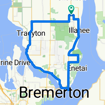 East Bremerton Loop
- Distance
- 21.1 km
- Ascent
- 372 m
- Descent
- 370 m
- Location
- Tracyton, Washington, United States of America
 69 NE Mulberry Ln, Bremerton to 69 NE Mulberry Ln, Bremerton
- Distance
- 8.5 km
- Ascent
- 119 m
- Descent
- 82 m
- Location
- Tracyton, Washington, United States of America
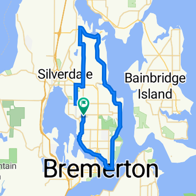 Bremerton to Keyport loop. (ignore detour on central vally)
- Distance
- 38.4 km
- Ascent
- 470 m
- Descent
- 448 m
- Location
- Tracyton, Washington, United States of America
Open it in the app