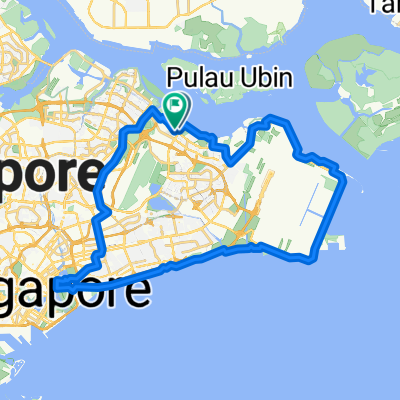
Punggol East, Singapore to Kallang, Singapore
- 49.6 km
- 125 m
- 130 m
- Singapore, Central Singapore Community Development Council, Singapore
A cycling route starting in Singapore, Central Singapore Community Development Council, Singapore.
Overview
created this 3 years ago
Route quality
Pedestrian area
4.4 km
(65 %)
Cycleway
2.3 km
(34 %)
Quiet road
0.1 km
(1 %)
Paved
3.6 km
(53 %)
Concrete
3 km
(44 %)
Asphalt
0.6 km
(9 %)
Undefined
3.2 km
(47 %)
Continue with Bikemap
You would like to ride Block 334D Yishun St 31, to 19A Sembawang Rd, or customize it for your own trip? Here is what you can do with this Bikemap route:
Free trial for 3 days, or one-time payment. More about Bikemap Premium.
Discover more Premium features.
Get Bikemap PremiumFrom our community
Open it in the app