

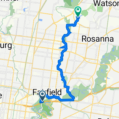
Studley Ward, Kew to 28 Ely St, Eltham
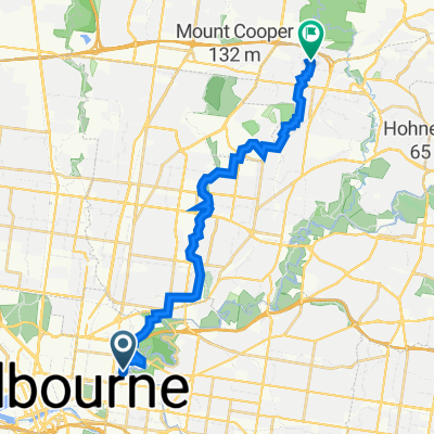
A cycling route starting in Abbotsford, Victoria, Australia.
Overview
About this route
- 1 h 58 min
- Duration
- 26.8 km
- Distance
- 315 m
- Ascent
- 313 m
- Descent
- 13.6 km/h
- Avg. speed
- 47 m
- Max. altitude
Route quality
Waytypes & surfaces along the route
Waytypes
Cycleway
19.9 km
(74 %)
Road
3 km
(11 %)
Surfaces
Paved
21.2 km
(79 %)
Unpaved
4.8 km
(18 %)
Asphalt
14.8 km
(55 %)
Concrete
4 km
(15 %)
Continue with Bikemap
Use, edit, or download this cycling route
You would like to ride Studley Ward, Kew to 28 Ely St, Eltham or customize it for your own trip? Here is what you can do with this Bikemap route:
Free features
- Save this route as favorite or in collections
- Copy & plan your own version of this route
- Sync your route with Garmin or Wahoo
Premium features
Free trial for 3 days, or one-time payment. More about Bikemap Premium.
- Navigate this route on iOS & Android
- Export a GPX / KML file of this route
- Create your custom printout (try it for free)
- Download this route for offline navigation
Discover more Premium features.
Get Bikemap PremiumFrom our community
Other popular routes starting in Abbotsford
 Yarra Bend Road 201, Fairfield to The Agora 6A, Bundoora
- Distance
- 15.7 km
- Ascent
- 135 m
- Descent
- 94 m
- Location
- Abbotsford, Victoria, Australia
 Merri Creek Trail to South Morang Rail Trail
- Distance
- 35.4 km
- Ascent
- 312 m
- Descent
- 220 m
- Location
- Abbotsford, Victoria, Australia
 Kew Boulevard
- Distance
- 6.5 km
- Ascent
- 185 m
- Descent
- 206 m
- Location
- Abbotsford, Victoria, Australia
 98 Nicholson St, Abbotsford to 27 Binnak Dr, Watsonia North
- Distance
- 22.4 km
- Ascent
- 231 m
- Descent
- 164 m
- Location
- Abbotsford, Victoria, Australia
 half of the capital city trail
- Distance
- 13.6 km
- Ascent
- 87 m
- Descent
- 93 m
- Location
- Abbotsford, Victoria, Australia
 Merri Creek, Moonee Ponds Creek Loop
- Distance
- 48 km
- Ascent
- 141 m
- Descent
- 140 m
- Location
- Abbotsford, Victoria, Australia
 Mernda from Abbotsford Convent
- Distance
- 76 km
- Ascent
- 246 m
- Descent
- 245 m
- Location
- Abbotsford, Victoria, Australia
 Walmer Street Diversion - Yarra Trail
- Distance
- 4.1 km
- Ascent
- 33 m
- Descent
- 75 m
- Location
- Abbotsford, Victoria, Australia
Open it in the app