

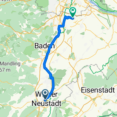
Wr. Neustadt - Reichenau Schwarzatal
A cycling route starting in Wiener Neustadt, Lower Austria, Austria.
Overview
About this route
- -:--
- Duration
- 50.4 km
- Distance
- 330 m
- Ascent
- 108 m
- Descent
- ---
- Avg. speed
- 490 m
- Max. altitude
Route quality
Waytypes & surfaces along the route
Waytypes
Quiet road
22.7 km
(45 %)
Cycleway
9.6 km
(19 %)
Surfaces
Paved
43.3 km
(86 %)
Unpaved
0.5 km
(1 %)
Asphalt
43.3 km
(86 %)
Gravel
0.5 km
(1 %)
Undefined
6.6 km
(13 %)
Route highlights
Points of interest along the route
Accommodation after 47.7 km
PAyerbacher Hof
Continue with Bikemap
Use, edit, or download this cycling route
You would like to ride Wr. Neustadt - Reichenau Schwarzatal or customize it for your own trip? Here is what you can do with this Bikemap route:
Free features
- Save this route as favorite or in collections
- Copy & plan your own version of this route
- Sync your route with Garmin or Wahoo
Premium features
Free trial for 3 days, or one-time payment. More about Bikemap Premium.
- Navigate this route on iOS & Android
- Export a GPX / KML file of this route
- Create your custom printout (try it for free)
- Download this route for offline navigation
Discover more Premium features.
Get Bikemap PremiumFrom our community
Other popular routes starting in Wiener Neustadt
 Tag 2 Lufla 2025 Wiener Neustadt nach Wien
- Distance
- 84.1 km
- Ascent
- 884 m
- Descent
- 947 m
- Location
- Wiener Neustadt, Lower Austria, Austria
 4_Bergerl_Runde
- Distance
- 103.6 km
- Ascent
- 1,479 m
- Descent
- 1,463 m
- Location
- Wiener Neustadt, Lower Austria, Austria
 Ausfahrt durch Gemeinde Wiener Neustadt
- Distance
- 26.7 km
- Ascent
- 64 m
- Descent
- 63 m
- Location
- Wiener Neustadt, Lower Austria, Austria
 Peaks of Pain
- Distance
- 144.4 km
- Ascent
- 3,034 m
- Descent
- 2,951 m
- Location
- Wiener Neustadt, Lower Austria, Austria
 Od Tine do Stefana
- Distance
- 53.6 km
- Ascent
- 98 m
- Descent
- 167 m
- Location
- Wiener Neustadt, Lower Austria, Austria
 Wr. Neustadt - Reichenau Schwarzatal
- Distance
- 50.4 km
- Ascent
- 330 m
- Descent
- 108 m
- Location
- Wiener Neustadt, Lower Austria, Austria
 Wiener Neustadt - Leopoldsdorf
- Distance
- 47.3 km
- Ascent
- 55 m
- Descent
- 146 m
- Location
- Wiener Neustadt, Lower Austria, Austria
 DQ Runde Rosalia BZF
- Distance
- 59.1 km
- Ascent
- 927 m
- Descent
- 921 m
- Location
- Wiener Neustadt, Lower Austria, Austria
Open it in the app