
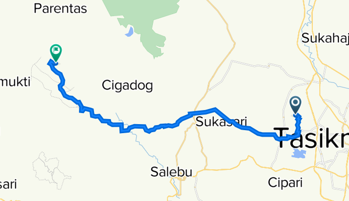
M5QM+WPH, Kecamatan Bungursari to Curug Ciparay Tasikmalaya, Kecamatan Cigalontang
A cycling route starting in Rancageneng Satu, West Java, Indonesia.
Overview
About this route
- 2 h 4 min
- Duration
- 26.3 km
- Distance
- 649 m
- Ascent
- 227 m
- Descent
- 12.7 km/h
- Avg. speed
- 864 m
- Max. altitude

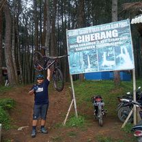
Route photos


Route quality
Waytypes & surfaces along the route
Waytypes
Quiet road
17.6 km
(67 %)
Road
8.7 km
(33 %)
Surfaces
Paved
2.9 km
(11 %)
Asphalt
2.9 km
(11 %)
Undefined
23.4 km
(89 %)
Continue with Bikemap
Use, edit, or download this cycling route
You would like to ride M5QM+WPH, Kecamatan Bungursari to Curug Ciparay Tasikmalaya, Kecamatan Cigalontang or customize it for your own trip? Here is what you can do with this Bikemap route:
Free features
- Save this route as favorite or in collections
- Copy & plan your own version of this route
- Sync your route with Garmin or Wahoo
Premium features
Free trial for 3 days, or one-time payment. More about Bikemap Premium.
- Navigate this route on iOS & Android
- Export a GPX / KML file of this route
- Create your custom printout (try it for free)
- Download this route for offline navigation
Discover more Premium features.
Get Bikemap PremiumFrom our community
Other popular routes starting in Rancageneng Satu
 M5QM+WPH, Kecamatan Bungursari to Curug Ciparay Tasikmalaya, Kecamatan Cigalontang
- Distance
- 26.3 km
- Ascent
- 649 m
- Descent
- 227 m
- Location
- Rancageneng Satu, West Java, Indonesia
 Unnamed Road, Kecamatan Bungursari to Unnamed Road, Kecamatan Bungursari
- Distance
- 12.9 km
- Ascent
- 201 m
- Descent
- 110 m
- Location
- Rancageneng Satu, West Java, Indonesia
Open it in the app