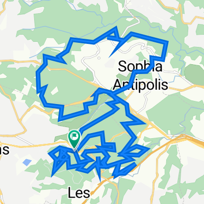
mgn grss 48
A cycling route starting in Mougins, Provence-Alpes-Côte d'Azur Region, France.
Overview
About this route
- -:--
- Duration
- 48.6 km
- Distance
- 642 m
- Ascent
- 640 m
- Descent
- ---
- Avg. speed
- ---
- Avg. speed
Route quality
Waytypes & surfaces along the route
Waytypes
Busy road
34.6 km
(71 %)
Road
7.1 km
(15 %)
Surfaces
Paved
37.3 km
(77 %)
Asphalt
37.3 km
(77 %)
Paved (undefined)
0 km
(<1 %)
Undefined
11.3 km
(23 %)
Continue with Bikemap
Use, edit, or download this cycling route
You would like to ride mgn grss 48 or customize it for your own trip? Here is what you can do with this Bikemap route:
Free features
- Save this route as favorite or in collections
- Copy & plan your own version of this route
- Sync your route with Garmin or Wahoo
Premium features
Free trial for 3 days, or one-time payment. More about Bikemap Premium.
- Navigate this route on iOS & Android
- Export a GPX / KML file of this route
- Create your custom printout (try it for free)
- Download this route for offline navigation
Discover more Premium features.
Get Bikemap PremiumFrom our community
Other popular routes starting in Mougins
- 88km loop from Mougins
- Distance
- 87.9 km
- Ascent
- 1,482 m
- Descent
- 1,483 m
- Location
- Mougins, Provence-Alpes-Côte d'Azur Region, France
- 502–558 Route d'Antibes, Mougins à 502–558 Route d'Antibes, Mougins
- Distance
- 19.2 km
- Ascent
- 382 m
- Descent
- 384 m
- Location
- Mougins, Provence-Alpes-Côte d'Azur Region, France
- Office -- Home
- Distance
- 12 km
- Ascent
- 81 m
- Descent
- 217 m
- Location
- Mougins, Provence-Alpes-Côte d'Azur Region, France
- Cap Ferrat
- Distance
- 40.2 km
- Ascent
- 242 m
- Descent
- 405 m
- Location
- Mougins, Provence-Alpes-Côte d'Azur Region, France
- mgn grss 48
- Distance
- 48.6 km
- Ascent
- 642 m
- Descent
- 640 m
- Location
- Mougins, Provence-Alpes-Côte d'Azur Region, France
- 06 W Valmasque 38K V52
- Distance
- 38.2 km
- Ascent
- 416 m
- Descent
- 416 m
- Location
- Mougins, Provence-Alpes-Côte d'Azur Region, France
- 06 W Valmasque Sud 9K
- Distance
- 9 km
- Ascent
- 156 m
- Descent
- 160 m
- Location
- Mougins, Provence-Alpes-Côte d'Azur Region, France
- Le Loup
- Distance
- 57.6 km
- Ascent
- 882 m
- Descent
- 910 m
- Location
- Mougins, Provence-Alpes-Côte d'Azur Region, France
Open it in the app