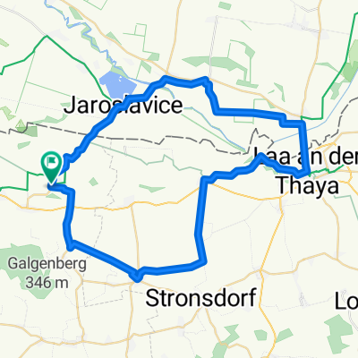
Ein Tal am Rad Alternative
A cycling route starting in Hadres, Lower Austria, Austria.
Overview
About this route
- -:--
- Duration
- 69.1 km
- Distance
- 457 m
- Ascent
- 459 m
- Descent
- ---
- Avg. speed
- 310 m
- Avg. speed
Route quality
Waytypes & surfaces along the route
Waytypes
Road
28.4 km
(41 %)
Track
17.9 km
(26 %)
Surfaces
Paved
34.6 km
(50 %)
Unpaved
2.1 km
(3 %)
Asphalt
33.1 km
(48 %)
Paved (undefined)
1.5 km
(2 %)
Continue with Bikemap
Use, edit, or download this cycling route
You would like to ride Ein Tal am Rad Alternative or customize it for your own trip? Here is what you can do with this Bikemap route:
Free features
- Save this route as favorite or in collections
- Copy & plan your own version of this route
- Sync your route with Garmin or Wahoo
Premium features
Free trial for 3 days, or one-time payment. More about Bikemap Premium.
- Navigate this route on iOS & Android
- Export a GPX / KML file of this route
- Create your custom printout (try it for free)
- Download this route for offline navigation
Discover more Premium features.
Get Bikemap PremiumFrom our community
Other popular routes starting in Hadres
- Weinradroute - Portugieser
- Distance
- 74.3 km
- Ascent
- 433 m
- Descent
- 428 m
- Location
- Hadres, Lower Austria, Austria
- Erste Bank Pensionistenradausflug Znaim
- Distance
- 80.2 km
- Ascent
- 926 m
- Descent
- 924 m
- Location
- Hadres, Lower Austria, Austria
- Weinviertel Tag 3 (Naturjuwelradweg)
- Distance
- 62.5 km
- Ascent
- 149 m
- Descent
- 147 m
- Location
- Hadres, Lower Austria, Austria
- Weinviertel Tag 1 (Chardonnay)
- Distance
- 55.6 km
- Ascent
- 362 m
- Descent
- 360 m
- Location
- Hadres, Lower Austria, Austria
- Iron Curtain Trail 7
- Distance
- 24.7 km
- Ascent
- 94 m
- Descent
- 101 m
- Location
- Hadres, Lower Austria, Austria
- Großkadolz, Retz, Haugsdorf, Großkadolz
- Distance
- 51.1 km
- Ascent
- 346 m
- Descent
- 348 m
- Location
- Hadres, Lower Austria, Austria
- Ä#Ò–? nach Ä#Ò–?
- Distance
- 15.7 km
- Ascent
- 10 m
- Descent
- 0 m
- Location
- Hadres, Lower Austria, Austria
- Großkadolz
- Distance
- 44.8 km
- Ascent
- 557 m
- Descent
- 557 m
- Location
- Hadres, Lower Austria, Austria
Open it in the app