

Tafeljura-Tour - Tafeljura-Tour
A cycling route starting in Läufelfingen, Basel-Landschaft, Switzerland.
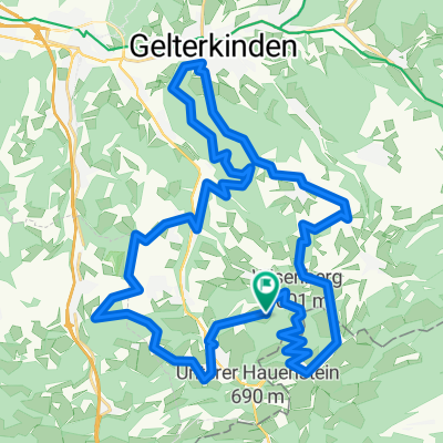
Overview
About this route
From Bad Ramsach high above Läufelfingen, this beautiful tour takes you through Oberbaselbieter municipalities and back to Bad Ramsach.
- -:--
- Duration
- 40.7 km
- Distance
- 781 m
- Ascent
- 914 m
- Descent
- ---
- Avg. speed
- 739 m
- Max. altitude

Route quality
Waytypes & surfaces along the route
Waytypes
Road
16.7 km
(41 %)
Quiet road
11 km
(27 %)
Surfaces
Paved
27.6 km
(68 %)
Unpaved
6.9 km
(17 %)
Asphalt
26 km
(64 %)
Gravel
6.1 km
(15 %)
Continue with Bikemap
Use, edit, or download this cycling route
You would like to ride Tafeljura-Tour - Tafeljura-Tour or customize it for your own trip? Here is what you can do with this Bikemap route:
Free features
- Save this route as favorite or in collections
- Copy & plan your own version of this route
- Sync your route with Garmin or Wahoo
Premium features
Free trial for 3 days, or one-time payment. More about Bikemap Premium.
- Navigate this route on iOS & Android
- Export a GPX / KML file of this route
- Create your custom printout (try it for free)
- Download this route for offline navigation
Discover more Premium features.
Get Bikemap PremiumFrom our community
Other popular routes starting in Läufelfingen
 TOSCADAY Bike 25 km, 700 Hm
- Distance
- 24.6 km
- Ascent
- 680 m
- Descent
- 680 m
- Location
- Läufelfingen, Basel-Landschaft, Switzerland
 RAD - 13 - Bad Ramsach - Basel
- Distance
- 32.5 km
- Ascent
- 109 m
- Descent
- 595 m
- Location
- Läufelfingen, Basel-Landschaft, Switzerland
 Wisen-Maren-Lostorf-Wisen
- Distance
- 14.1 km
- Ascent
- 525 m
- Descent
- 525 m
- Location
- Läufelfingen, Basel-Landschaft, Switzerland
 BL Läufelfingen - Läufelfingn
- Distance
- 31.2 km
- Ascent
- 438 m
- Descent
- 440 m
- Location
- Läufelfingen, Basel-Landschaft, Switzerland
 TOSCADAY Bike 40 km, 1250 Hm
- Distance
- 39.1 km
- Ascent
- 1,146 m
- Descent
- 1,146 m
- Location
- Läufelfingen, Basel-Landschaft, Switzerland
 Ifenthalerstrasse 68, Hauenstein nach Ifenthalerstrasse 68, Hauenstein
- Distance
- 6.7 km
- Ascent
- 248 m
- Descent
- 252 m
- Location
- Läufelfingen, Basel-Landschaft, Switzerland
 Im Oberdorf 3, Eptingen nach Leisenstrasse 1, Eptingen
- Distance
- 10.8 km
- Ascent
- 425 m
- Descent
- 434 m
- Location
- Läufelfingen, Basel-Landschaft, Switzerland
 wisen Hauptstraße.
- Distance
- 18.7 km
- Ascent
- 174 m
- Descent
- 456 m
- Location
- Läufelfingen, Basel-Landschaft, Switzerland
Open it in the app