
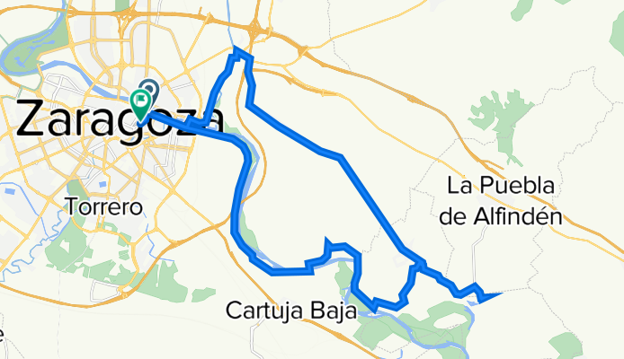
Paseo de Echegaray y Caballero, Zaragoza a Calle de San Lorenzo, 52, Zaragoza
A cycling route starting in Zaragoza, Aragon, Spain.
Overview
About this route
- 2 h
- Duration
- 33.4 km
- Distance
- 143 m
- Ascent
- 135 m
- Descent
- 16.7 km/h
- Avg. speed
- 209 m
- Max. altitude
Route quality
Waytypes & surfaces along the route
Waytypes
Track
13.7 km
(41 %)
Cycleway
6.1 km
(18 %)
Surfaces
Paved
10.2 km
(30 %)
Unpaved
0.6 km
(2 %)
Asphalt
7.3 km
(22 %)
Paving stones
1.7 km
(5 %)
Continue with Bikemap
Use, edit, or download this cycling route
You would like to ride Paseo de Echegaray y Caballero, Zaragoza a Calle de San Lorenzo, 52, Zaragoza or customize it for your own trip? Here is what you can do with this Bikemap route:
Free features
- Save this route as favorite or in collections
- Copy & plan your own version of this route
- Sync your route with Garmin or Wahoo
Premium features
Free trial for 3 days, or one-time payment. More about Bikemap Premium.
- Navigate this route on iOS & Android
- Export a GPX / KML file of this route
- Create your custom printout (try it for free)
- Download this route for offline navigation
Discover more Premium features.
Get Bikemap PremiumFrom our community
Other popular routes starting in Zaragoza
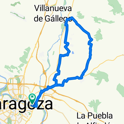
 Zaragoza Galachos Juslibol
- Distance
- 28.3 km
- Ascent
- 51 m
- Descent
- 58 m
- Location
- Zaragoza, Aragon, Spain
 ZARAGOZA-LAS PLANAS PROGRESIVA-EL MONTAÑES
- Distance
- 58.6 km
- Ascent
- 489 m
- Descent
- 489 m
- Location
- Zaragoza, Aragon, Spain
 cvcvcv
- Distance
- 15.3 km
- Ascent
- 100 m
- Descent
- 104 m
- Location
- Zaragoza, Aragon, Spain
 Quick ride through Zaragoza
- Distance
- 6.4 km
- Ascent
- 78 m
- Descent
- 78 m
- Location
- Zaragoza, Aragon, Spain
 Parque Tío Jorge - Anillo Verde - Parque Tío Jorge
- Distance
- 31.9 km
- Ascent
- 128 m
- Descent
- 126 m
- Location
- Zaragoza, Aragon, Spain
 Almuerzo en Peñaflor
- Distance
- 40 km
- Ascent
- 118 m
- Descent
- 116 m
- Location
- Zaragoza, Aragon, Spain
 Villamayor - La Puebla de Alfinden
- Distance
- 36.4 km
- Ascent
- 94 m
- Descent
- 94 m
- Location
- Zaragoza, Aragon, Spain
 Zaragoza to Lecinena loop (plan)
- Distance
- 65.7 km
- Ascent
- 359 m
- Descent
- 351 m
- Location
- Zaragoza, Aragon, Spain
Open it in the app