

Three Bears, Orinda, CA (Loop only)
A cycling route starting in Orinda, California, United States.
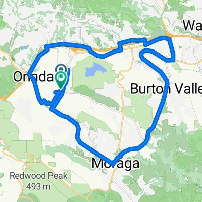
Overview
About this route
- -:--
- Duration
- 30.1 km
- Distance
- 513 m
- Ascent
- 524 m
- Descent
- ---
- Avg. speed
- ---
- Max. altitude
Route quality
Waytypes & surfaces along the route
Waytypes
Busy road
15.4 km
(51 %)
Road
13.9 km
(46 %)
Surfaces
Paved
5.6 km
(18 %)
Asphalt
5.6 km
(18 %)
Undefined
24.6 km
(82 %)
Continue with Bikemap
Use, edit, or download this cycling route
You would like to ride Three Bears, Orinda, CA (Loop only) or customize it for your own trip? Here is what you can do with this Bikemap route:
Free features
- Save this route as favorite or in collections
- Copy & plan your own version of this route
- Sync your route with Garmin or Wahoo
Premium features
Free trial for 3 days, or one-time payment. More about Bikemap Premium.
- Navigate this route on iOS & Android
- Export a GPX / KML file of this route
- Create your custom printout (try it for free)
- Download this route for offline navigation
Discover more Premium features.
Get Bikemap PremiumFrom our community
Other popular routes starting in Orinda
 "The Bears" Individual Time Trial (Grizzly Peak Cyclists) CLONED FROM ROUTE 321207
- Distance
- 30.2 km
- Ascent
- 524 m
- Descent
- 534 m
- Location
- Orinda, California, United States
 lamo loop
- Distance
- 38 km
- Ascent
- 311 m
- Descent
- 319 m
- Location
- Orinda, California, United States
 LaMOrinda half loop
- Distance
- 42 km
- Ascent
- 481 m
- Descent
- 470 m
- Location
- Orinda, California, United States
 ALC Ride 09, 39 miles
- Distance
- 30.9 km
- Ascent
- 403 m
- Descent
- 498 m
- Location
- Orinda, California, United States
 Low-Key Hillclimb: Lomas Cantadas via Loma Vista, El Toyonal
- Distance
- 3.9 km
- Ascent
- 370 m
- Descent
- 51 m
- Location
- Orinda, California, United States
 Around Orinda
- Distance
- 24 km
- Ascent
- 366 m
- Descent
- 370 m
- Location
- Orinda, California, United States
 GPC ASSR Adente (34 mile)
- Distance
- 51.3 km
- Ascent
- 659 m
- Descent
- 660 m
- Location
- Orinda, California, United States
 Castro Ranch Alhambra Reliez Happy Valley plus a Bear.
- Distance
- 50 km
- Ascent
- 733 m
- Descent
- 733 m
- Location
- Orinda, California, United States
Open it in the app