

Rundfahrt leider ohne Ziel
A cycling route starting in Lauchheim, Baden-Wurttemberg, Germany.
Overview
About this route
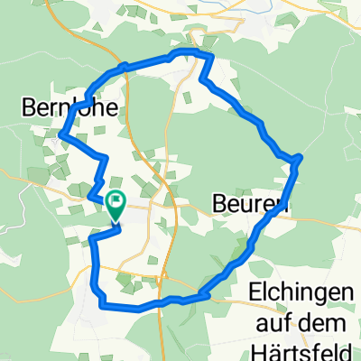
Eine abendliche Rundfahrt sollte es werden, endete aber leider wegen totaler Dunkelheit im Wald, weil ich eine falsche Abzweigung erwischt hatte.
Die Strecke an sich ist gut für den normalen Mountainbiker geeignet.
- -:--
- Duration
- 34 km
- Distance
- 323 m
- Ascent
- 294 m
- Descent
- ---
- Avg. speed
- ---
- Max. altitude
Continue with Bikemap
Use, edit, or download this cycling route
You would like to ride Rundfahrt leider ohne Ziel or customize it for your own trip? Here is what you can do with this Bikemap route:
Free features
- Save this route as favorite or in collections
- Copy & plan your own version of this route
- Sync your route with Garmin or Wahoo
Premium features
Free trial for 3 days, or one-time payment. More about Bikemap Premium.
- Navigate this route on iOS & Android
- Export a GPX / KML file of this route
- Create your custom printout (try it for free)
- Download this route for offline navigation
Discover more Premium features.
Get Bikemap PremiumFrom our community
Other popular routes starting in Lauchheim
 Lauchheim-Bartholomä-Uhingen Tag 4
- Distance
- 89.3 km
- Ascent
- 562 m
- Descent
- 718 m
- Location
- Lauchheim, Baden-Wurttemberg, Germany
 Von Waldhausen bis Unterschneidheim
- Distance
- 26.8 km
- Ascent
- 226 m
- Descent
- 355 m
- Location
- Lauchheim, Baden-Wurttemberg, Germany
 LauchNeulHofenLauch
- Distance
- 46.4 km
- Ascent
- 263 m
- Descent
- 264 m
- Location
- Lauchheim, Baden-Wurttemberg, Germany
 Tour 6 - Ipf-Ries-Runde
- Distance
- 42.1 km
- Ascent
- 415 m
- Descent
- 414 m
- Location
- Lauchheim, Baden-Wurttemberg, Germany
 Zwischen Jagst und Romantischer Straße
- Distance
- 68.3 km
- Ascent
- 4,494 m
- Descent
- 5,007 m
- Location
- Lauchheim, Baden-Wurttemberg, Germany
 Härtsfeldrunde 1
- Distance
- 36.9 km
- Ascent
- 376 m
- Descent
- 362 m
- Location
- Lauchheim, Baden-Wurttemberg, Germany
 Waldhäuser Rundfahrt
- Distance
- 25 km
- Ascent
- 168 m
- Descent
- 168 m
- Location
- Lauchheim, Baden-Wurttemberg, Germany
 Rodstein Oberkochen-Vorderes Härtsfeld
- Distance
- 33 km
- Ascent
- 320 m
- Descent
- 320 m
- Location
- Lauchheim, Baden-Wurttemberg, Germany
Open it in the app