

Radrundweg Neustadt - Hohwald - Radrundweg Neustadt - Hohwald
A cycling route starting in Neustadt in Sachsen, Saxony, Germany.
Overview
About this route
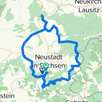
This naturally shaped bike tour goes around Neustadt in Saxony. A detour to the Unger with its observation tower is a must. Additionally, one can enjoy the atmosphere in Hohwald.
- -:--
- Duration
- 41.3 km
- Distance
- 671 m
- Ascent
- 668 m
- Descent
- ---
- Avg. speed
- 542 m
- Max. altitude

Route quality
Waytypes & surfaces along the route
Waytypes
Road
14 km
(34 %)
Track
13.2 km
(32 %)
Surfaces
Paved
32.6 km
(79 %)
Unpaved
6.2 km
(15 %)
Asphalt
29.3 km
(71 %)
Gravel
5.4 km
(13 %)
Continue with Bikemap
Use, edit, or download this cycling route
You would like to ride Radrundweg Neustadt - Hohwald - Radrundweg Neustadt - Hohwald or customize it for your own trip? Here is what you can do with this Bikemap route:
Free features
- Save this route as favorite or in collections
- Copy & plan your own version of this route
- Sync your route with Garmin or Wahoo
Premium features
Free trial for 3 days, or one-time payment. More about Bikemap Premium.
- Navigate this route on iOS & Android
- Export a GPX / KML file of this route
- Create your custom printout (try it for free)
- Download this route for offline navigation
Discover more Premium features.
Get Bikemap PremiumFrom our community
Other popular routes starting in Neustadt in Sachsen
 Dorfstraße 17A, Neustadt in Sachsen nach Dorfstraße 32, Neustadt in Sachsen
- Distance
- 33.6 km
- Ascent
- 306 m
- Descent
- 341 m
- Location
- Neustadt in Sachsen, Saxony, Germany
 Radrundweg Neustadt - Hohwald - Radrundweg Neustadt - Hohwald
- Distance
- 41.3 km
- Ascent
- 671 m
- Descent
- 668 m
- Location
- Neustadt in Sachsen, Saxony, Germany
 Tierpark Hebelei
- Distance
- 181.9 km
- Ascent
- 351 m
- Descent
- 351 m
- Location
- Neustadt in Sachsen, Saxony, Germany
 Dorfstraße 30, Neustadt in Sachsen nach Dorfstraße 32, Neustadt in Sachsen
- Distance
- 8.1 km
- Ascent
- 46 m
- Descent
- 45 m
- Location
- Neustadt in Sachsen, Saxony, Germany
 Am Achtlindenberg nach Hertigswalder Straße
- Distance
- 10.4 km
- Ascent
- 158 m
- Descent
- 237 m
- Location
- Neustadt in Sachsen, Saxony, Germany
 Hoher Hahn
- Distance
- 15.2 km
- Ascent
- 203 m
- Descent
- 202 m
- Location
- Neustadt in Sachsen, Saxony, Germany
 Krumhermsdorf-Kohlmühle-Krumhermsdorf
- Distance
- 20 km
- Ascent
- 388 m
- Descent
- 391 m
- Location
- Neustadt in Sachsen, Saxony, Germany
 Vom Bahnhof in Krumhermsdorf zum Marktplatz in Bad Schandau
- Distance
- 13.8 km
- Ascent
- 138 m
- Descent
- 429 m
- Location
- Neustadt in Sachsen, Saxony, Germany
Open it in the app