

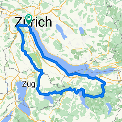
Schlosstour Aargau
A cycling route starting in Zürich (Kreis 3) / Alt-Wiedikon, Canton of Zurich, Switzerland.
Overview
About this route
- -:--
- Duration
- 123.2 km
- Distance
- 1,374 m
- Ascent
- 1,374 m
- Descent
- ---
- Avg. speed
- ---
- Max. altitude
Route quality
Waytypes & surfaces along the route
Waytypes
Road
49.3 km
(40 %)
Quiet road
28.3 km
(23 %)
Surfaces
Paved
90 km
(73 %)
Asphalt
88.7 km
(72 %)
Paved (undefined)
1.2 km
(1 %)
Undefined
33.3 km
(27 %)
Continue with Bikemap
Use, edit, or download this cycling route
You would like to ride Schlosstour Aargau or customize it for your own trip? Here is what you can do with this Bikemap route:
Free features
- Save this route as favorite or in collections
- Copy & plan your own version of this route
- Split it into stages to create a multi-day tour
- Sync your route with Garmin or Wahoo
Premium features
Free trial for 3 days, or one-time payment. More about Bikemap Premium.
- Navigate this route on iOS & Android
- Export a GPX / KML file of this route
- Create your custom printout (try it for free)
- Download this route for offline navigation
Discover more Premium features.
Get Bikemap PremiumFrom our community
Other popular routes starting in Zürich (Kreis 3) / Alt-Wiedikon
 Zürich-Sattelegg-Raten-Türlersee-Zürich
- Distance
- 122.9 km
- Ascent
- 1,958 m
- Descent
- 1,870 m
- Location
- Zürich (Kreis 3) / Alt-Wiedikon, Canton of Zurich, Switzerland
 Wolframplatz (Vision Apts) to Adliswil (Sood-Oberleimbach)
- Distance
- 5.6 km
- Ascent
- 24 m
- Descent
- 0 m
- Location
- Zürich (Kreis 3) / Alt-Wiedikon, Canton of Zurich, Switzerland
 noch eine Hausrunde
- Distance
- 44.9 km
- Ascent
- 543 m
- Descent
- 476 m
- Location
- Zürich (Kreis 3) / Alt-Wiedikon, Canton of Zurich, Switzerland
 Züri-Halwiler See - Züri kurz
- Distance
- 76.7 km
- Ascent
- 1,154 m
- Descent
- 1,154 m
- Location
- Zürich (Kreis 3) / Alt-Wiedikon, Canton of Zurich, Switzerland
 Ueteliberg Tour
- Distance
- 16.5 km
- Ascent
- 475 m
- Descent
- 489 m
- Location
- Zürich (Kreis 3) / Alt-Wiedikon, Canton of Zurich, Switzerland
 Wiedikon - Zugersee Runde
- Distance
- 98.2 km
- Ascent
- 959 m
- Descent
- 870 m
- Location
- Zürich (Kreis 3) / Alt-Wiedikon, Canton of Zurich, Switzerland
 Schlosstour Aargau
- Distance
- 123.2 km
- Ascent
- 1,374 m
- Descent
- 1,374 m
- Location
- Zürich (Kreis 3) / Alt-Wiedikon, Canton of Zurich, Switzerland
 Uetliberg+
- Distance
- 44.3 km
- Ascent
- 1,058 m
- Descent
- 1,058 m
- Location
- Zürich (Kreis 3) / Alt-Wiedikon, Canton of Zurich, Switzerland
Open it in the app