gunma
A cycling route starting in Maebashi, Gunma, Japan.
Overview
About this route
- -:--
 - Duration
 - 109.6 km
 - Distance
 - 2,096 m
 - Ascent
 - 2,094 m
 - Descent
 - ---
 - Avg. speed
 - 1,178 m
 - Max. altitude
 
Route quality
Waytypes & surfaces along the route
Waytypes
Quiet road
44.9 km
(41 %)
Cycleway
25.2 km
(23 %)
Surfaces
Paved
29.6 km
(27 %)
Asphalt
21.9 km
(20 %)
Paved (undefined)
7.7 km
(7 %)
Undefined
80 km
(73 %)
Continue with Bikemap
Use, edit, or download this cycling route
You would like to ride gunma or customize it for your own trip? Here is what you can do with this Bikemap route:
Free features
- Save this route as favorite or in collections
 - Copy & plan your own version of this route
 - Split it into stages to create a multi-day tour
 - Sync your route with Garmin or Wahoo
 
Premium features
Free trial for 3 days, or one-time payment. More about Bikemap Premium.
- Navigate this route on iOS & Android
 - Export a GPX / KML file of this route
 - Create your custom printout (try it for free)
 - Download this route for offline navigation
 
Discover more Premium features.
Get Bikemap PremiumFrom our community
Other popular routes starting in Maebashi
白井宿コース- Distance
 - 39 km
 - Ascent
 - 362 m
 - Descent
 - 358 m
 - Location
 - Maebashi, Gunma, Japan
 
市街地~敷島周遊コース- Distance
 - 11.9 km
 - Ascent
 - 55 m
 - Descent
 - 56 m
 - Location
 - Maebashi, Gunma, Japan
 
Maebashi to Itakura- Distance
 - 64.7 km
 - Ascent
 - 70 m
 - Descent
 - 160 m
 - Location
 - Maebashi, Gunma, Japan
 
maebashi to ikaho- Distance
 - 23.2 km
 - Ascent
 - 738 m
 - Descent
 - 82 m
 - Location
 - Maebashi, Gunma, Japan
 
2 Chome 29, Maebashi to 1-chōme 22, Maebashi- Distance
 - 5.6 km
 - Ascent
 - 29 m
 - Descent
 - 12 m
 - Location
 - Maebashi, Gunma, Japan
 
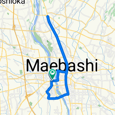
国領町 2-Chōme, 前橋市 a 国領町 2-Chōme, 前橋市- Distance
 - 92.9 km
 - Ascent
 - 1,676 m
 - Descent
 - 1,676 m
 - Location
 - Maebashi, Gunma, Japan
 
gunma- Distance
 - 109.6 km
 - Ascent
 - 2,096 m
 - Descent
 - 2,094 m
 - Location
 - Maebashi, Gunma, Japan
 
総社町, 前橋市 a 石倉町 4-Chōme, 前橋市- Distance
 - 22.1 km
 - Ascent
 - 165 m
 - Descent
 - 169 m
 - Location
 - Maebashi, Gunma, Japan
 
Open it in the app


