

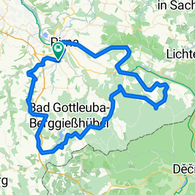
Nenntmannsdorf - Liebstadt - Schlottwitz - Glashütte - Luchau - Dippoldiswalde -Oelsa - Rabenau - Tharandt - Wilsdruff
A cycling route starting in Dohma, Saxony, Germany.
Overview
About this route
Distance ridden on: 24.10.2009CM 4.4A : 70.06 km | 982 m gain---------------------------------------Riding time 02:48:19 at Ø 24.9 km/h... my sister kindly took me (and my racing bike) by car towards Saxon Switzerland ;-) ... hence the 'unusual' starting pointand it obviously did not become a loop
- -:--
- Duration
- 68.6 km
- Distance
- 826 m
- Ascent
- 856 m
- Descent
- ---
- Avg. speed
- ---
- Max. altitude

Route quality
Waytypes & surfaces along the route
Waytypes
Road
15.1 km
(22 %)
Quiet road
8.2 km
(12 %)
Surfaces
Paved
55.6 km
(81 %)
Unpaved
0.7 km
(1 %)
Asphalt
55.6 km
(81 %)
Gravel
0.7 km
(1 %)
Undefined
12.4 km
(18 %)
Continue with Bikemap
Use, edit, or download this cycling route
You would like to ride Nenntmannsdorf - Liebstadt - Schlottwitz - Glashütte - Luchau - Dippoldiswalde -Oelsa - Rabenau - Tharandt - Wilsdruff or customize it for your own trip? Here is what you can do with this Bikemap route:
Free features
- Save this route as favorite or in collections
- Copy & plan your own version of this route
- Sync your route with Garmin or Wahoo
Premium features
Free trial for 3 days, or one-time payment. More about Bikemap Premium.
- Navigate this route on iOS & Android
- Export a GPX / KML file of this route
- Create your custom printout (try it for free)
- Download this route for offline navigation
Discover more Premium features.
Get Bikemap PremiumFrom our community
Other popular routes starting in Dohma
 Entspannungsrunde
- Distance
- 16.5 km
- Ascent
- 295 m
- Descent
- 290 m
- Location
- Dohma, Saxony, Germany
 Runde um Augustusberg
- Distance
- 18.8 km
- Ascent
- 270 m
- Descent
- 270 m
- Location
- Dohma, Saxony, Germany
 Talsperre Hartmannsbach
- Distance
- 14.8 km
- Ascent
- 247 m
- Descent
- 245 m
- Location
- Dohma, Saxony, Germany
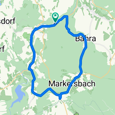
 Osterzgebirge
- Distance
- 62 km
- Ascent
- 674 m
- Descent
- 671 m
- Location
- Dohma, Saxony, Germany
 Nenntmannsdorf - Liebstadt - Schlottwitz - Glashütte - Luchau - Dippoldiswalde -Oelsa - Rabenau - Tharandt - Wilsdruff
- Distance
- 68.6 km
- Ascent
- 826 m
- Descent
- 856 m
- Location
- Dohma, Saxony, Germany
 Berggießhübel-Gersdorf-Gottleuba-Bergg
- Distance
- 19.3 km
- Ascent
- 349 m
- Descent
- 350 m
- Location
- Dohma, Saxony, Germany
 Die Entspannungstour zum Feierabend
- Distance
- 15.3 km
- Ascent
- 271 m
- Descent
- 271 m
- Location
- Dohma, Saxony, Germany
 Burgenland ab Pirna
- Distance
- 89.5 km
- Ascent
- 1,037 m
- Descent
- 1,037 m
- Location
- Dohma, Saxony, Germany
Open it in the app