

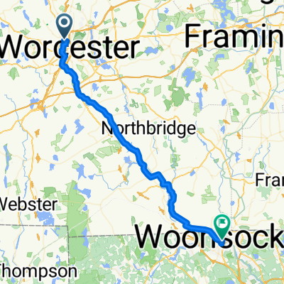
Indian Lake East, Worcester to 117 Worcester Rd, Sterling
A cycling route starting in Worcester, Massachusetts, United States of America.
Overview
About this route
- 2 h 25 min
- Duration
- 33 km
- Distance
- 605 m
- Ascent
- 632 m
- Descent
- 13.7 km/h
- Avg. speed
- 347 m
- Avg. speed

Route quality
Waytypes & surfaces along the route
Waytypes
Busy road
19.4 km
(59 %)
Road
9 km
(27 %)
Surfaces
Paved
14.1 km
(43 %)
Unpaved
0.3 km
(<1 %)
Asphalt
13.5 km
(41 %)
Paved (undefined)
0.6 km
(2 %)
Continue with Bikemap
Use, edit, or download this cycling route
You would like to ride Indian Lake East, Worcester to 117 Worcester Rd, Sterling or customize it for your own trip? Here is what you can do with this Bikemap route:
Free features
- Save this route as favorite or in collections
- Copy & plan your own version of this route
- Sync your route with Garmin or Wahoo
Premium features
Free trial for 3 days, or one-time payment. More about Bikemap Premium.
- Navigate this route on iOS & Android
- Export a GPX / KML file of this route
- Create your custom printout (try it for free)
- Download this route for offline navigation
Discover more Premium features.
Get Bikemap PremiumFrom our community
Other popular routes starting in Worcester
 Worcester
- Distance
- 25.5 km
- Ascent
- 296 m
- Descent
- 296 m
- Location
- Worcester, Massachusetts, United States of America
 Oct. 25, 2017
- Distance
- 48.4 km
- Ascent
- 405 m
- Descent
- 405 m
- Location
- Worcester, Massachusetts, United States of America
 Main Street 1059, Worcester to Main Street 1059, Worcester
- Distance
- 56.2 km
- Ascent
- 414 m
- Descent
- 418 m
- Location
- Worcester, Massachusetts, United States of America
 Worcester to Tyngsboro
- Distance
- 84.2 km
- Ascent
- 847 m
- Descent
- 961 m
- Location
- Worcester, Massachusetts, United States of America
 blackstone path
- Distance
- 48.5 km
- Ascent
- 254 m
- Descent
- 352 m
- Location
- Worcester, Massachusetts, United States of America
 9 Hackfeld Rd, Worcester to 7 Woodland Ct, Princeton Junction
- Distance
- 406.6 km
- Ascent
- 2,788 m
- Descent
- 2,913 m
- Location
- Worcester, Massachusetts, United States of America
 Beechmont Street 7, Worcester to Stowell Avenue 2A, Worcester
- Distance
- 8.3 km
- Ascent
- 46 m
- Descent
- 68 m
- Location
- Worcester, Massachusetts, United States of America
 Ashmont Ave, Worcester to 4 Ashmont Ave, Worcester
- Distance
- 837.4 km
- Ascent
- 166 m
- Descent
- 169 m
- Location
- Worcester, Massachusetts, United States of America
Open it in the app