

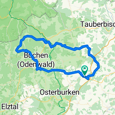
17. Altheim (D) - Bad Windsheim (D)
A cycling route starting in Rosenberg, Baden-Wurttemberg, Germany.
Overview
About this route
July 7, 2011
- -:--
- Duration
- 94.7 km
- Distance
- 721 m
- Ascent
- 723 m
- Descent
- ---
- Avg. speed
- ---
- Max. altitude

Route quality
Waytypes & surfaces along the route
Waytypes
Road
18.9 km
(20 %)
Quiet road
8.5 km
(9 %)
Surfaces
Paved
72 km
(76 %)
Unpaved
2.8 km
(3 %)
Asphalt
69.1 km
(73 %)
Paved (undefined)
2.8 km
(3 %)
Route highlights
Points of interest along the route
Point of interest after 0 km
Robaczki świętojańskie
Point of interest after 91.6 km
Nawałnica
Continue with Bikemap
Use, edit, or download this cycling route
You would like to ride 17. Altheim (D) - Bad Windsheim (D) or customize it for your own trip? Here is what you can do with this Bikemap route:
Free features
- Save this route as favorite or in collections
- Copy & plan your own version of this route
- Split it into stages to create a multi-day tour
- Sync your route with Garmin or Wahoo
Premium features
Free trial for 3 days, or one-time payment. More about Bikemap Premium.
- Navigate this route on iOS & Android
- Export a GPX / KML file of this route
- Create your custom printout (try it for free)
- Download this route for offline navigation
Discover more Premium features.
Get Bikemap PremiumFrom our community
Other popular routes starting in Rosenberg
 Altheim-Osterburken
- Distance
- 11.4 km
- Ascent
- 215 m
- Descent
- 218 m
- Location
- Rosenberg, Baden-Wurttemberg, Germany
 17. Altheim (D) - Bad Windsheim (D)
- Distance
- 94.7 km
- Ascent
- 721 m
- Descent
- 723 m
- Location
- Rosenberg, Baden-Wurttemberg, Germany
 Seckach-Jagst-Tour 42 km
- Distance
- 50.4 km
- Ascent
- 268 m
- Descent
- 361 m
- Location
- Rosenberg, Baden-Wurttemberg, Germany
 Walldürn
- Distance
- 10.1 km
- Ascent
- 165 m
- Descent
- 64 m
- Location
- Rosenberg, Baden-Wurttemberg, Germany
 Tag 1: Walldürn-Altheim nach Ittlingen Hauptstraße 4
- Distance
- 76.6 km
- Ascent
- 301 m
- Descent
- 468 m
- Location
- Rosenberg, Baden-Wurttemberg, Germany
 Boxberg Odenwald RR on AllTrails
- Distance
- 77 km
- Ascent
- 1,543 m
- Descent
- 1,546 m
- Location
- Rosenberg, Baden-Wurttemberg, Germany
 Alt-Ost-Rappenau-Eppingen
- Distance
- 85.1 km
- Ascent
- 442 m
- Descent
- 552 m
- Location
- Rosenberg, Baden-Wurttemberg, Germany
 Geranienstraße, Walldürn Buchen Adelsheim Osterburken Altheim
- Distance
- 60.8 km
- Ascent
- 671 m
- Descent
- 669 m
- Location
- Rosenberg, Baden-Wurttemberg, Germany
Open it in the app