

2023-07-23 Ruta Nº 064
A cycling route starting in Valladolid, Castille and León, Spain.
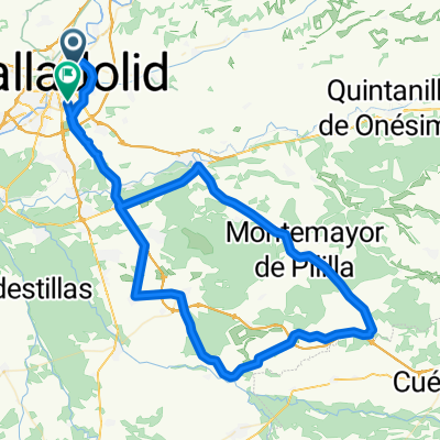
Overview
About this route
Ronda -Ctra.Segovia - Rotonda Otero -Tudela -La parrilla -Montemayor -Viloria del Henar -San Miguel del Arroyo -Megeces -Portillo -La Pedraja -(rotonda el Otero)-La Corala- Valladolid.
1ª Cuesta La Parrilla Pendiente media 5,2% Distancia 3 Km.
2ª La Garganta - VteSur Pendiente media 5,3% - Distancia 2,2 Km.
- -:--
- Duration
- 99.6 km
- Distance
- 613 m
- Ascent
- 616 m
- Descent
- ---
- Avg. speed
- 878 m
- Max. altitude

Route quality
Waytypes & surfaces along the route
Waytypes
Road
59.8 km
(60 %)
Quiet road
13.9 km
(14 %)
Surfaces
Paved
69.7 km
(70 %)
Unpaved
4 km
(4 %)
Asphalt
69.7 km
(70 %)
Gravel
3 km
(3 %)
Route highlights
Points of interest along the route
Point of interest after 28.4 km
Cuesta La Parrilla Pendiente media 5,2% Distancia 3 Km.
Point of interest after 70.1 km
La Garganta - VteSur Pendiente media 5,3% - Distancia 2,2 Km.
Continue with Bikemap
Use, edit, or download this cycling route
You would like to ride 2023-07-23 Ruta Nº 064 or customize it for your own trip? Here is what you can do with this Bikemap route:
Free features
- Save this route as favorite or in collections
- Copy & plan your own version of this route
- Split it into stages to create a multi-day tour
- Sync your route with Garmin or Wahoo
Premium features
Free trial for 3 days, or one-time payment. More about Bikemap Premium.
- Navigate this route on iOS & Android
- Export a GPX / KML file of this route
- Create your custom printout (try it for free)
- Download this route for offline navigation
Discover more Premium features.
Get Bikemap PremiumFrom our community
Other popular routes starting in Valladolid
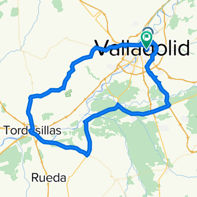
 2022 Ruta Nº 065
- Distance
- 99.9 km
- Ascent
- 711 m
- Descent
- 715 m
- Location
- Valladolid, Castille and León, Spain
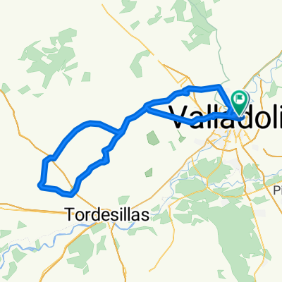
 vueltecilla mtb
- Distance
- 21.9 km
- Ascent
- 168 m
- Descent
- 159 m
- Location
- Valladolid, Castille and León, Spain
 2022 - Ruta nº 096
- Distance
- 97.2 km
- Ascent
- 2,072 m
- Descent
- 2,072 m
- Location
- Valladolid, Castille and León, Spain
 Ruta: 20-Mayo-2018 - (PM - Amistad)
- Distance
- 92.8 km
- Ascent
- 435 m
- Descent
- 431 m
- Location
- Valladolid, Castille and León, Spain
 Orilla Rio
- Distance
- 40.3 km
- Ascent
- 115 m
- Descent
- 115 m
- Location
- Valladolid, Castille and León, Spain
 2022 - Ruta nº 073
- Distance
- 101.3 km
- Ascent
- 730 m
- Descent
- 732 m
- Location
- Valladolid, Castille and León, Spain
 Circuito: VAREVITUCI
- Distance
- 37.6 km
- Ascent
- 303 m
- Descent
- 303 m
- Location
- Valladolid, Castille and León, Spain
 2022 - Ruta nº 051
- Distance
- 113.5 km
- Ascent
- 833 m
- Descent
- 829 m
- Location
- Valladolid, Castille and León, Spain
Open it in the app