

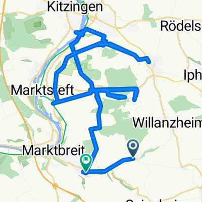
Rundtour durch den südl. Steigerwald
A cycling route starting in Willanzheim, Bavaria, Germany.
Overview
About this route
The circular route mainly leads over land consolidation paths and lightly trafficked side roads. In the southern area, part of it goes over partly steeply rising forest paths.
- -:--
- Duration
- 50.5 km
- Distance
- 495 m
- Ascent
- 476 m
- Descent
- ---
- Avg. speed
- 471 m
- Max. altitude
Route quality
Waytypes & surfaces along the route
Waytypes
Track
23.7 km
(47 %)
Quiet road
13.6 km
(27 %)
Surfaces
Paved
21.2 km
(42 %)
Unpaved
10.1 km
(20 %)
Asphalt
14.1 km
(28 %)
Gravel
9.1 km
(18 %)
Continue with Bikemap
Use, edit, or download this cycling route
You would like to ride Rundtour durch den südl. Steigerwald or customize it for your own trip? Here is what you can do with this Bikemap route:
Free features
- Save this route as favorite or in collections
- Copy & plan your own version of this route
- Sync your route with Garmin or Wahoo
Premium features
Free trial for 3 days, or one-time payment. More about Bikemap Premium.
- Navigate this route on iOS & Android
- Export a GPX / KML file of this route
- Create your custom printout (try it for free)
- Download this route for offline navigation
Discover more Premium features.
Get Bikemap PremiumFrom our community
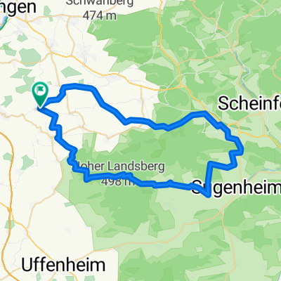
Other popular routes starting in Willanzheim
 Kindergartenstraße 11, Willanzheim nach Kindergartenstraße 4, Willanzheim
- Distance
- 18.7 km
- Ascent
- 255 m
- Descent
- 246 m
- Location
- Willanzheim, Bavaria, Germany
 Rundtour um den südl. Steigerwald
- Distance
- 56.7 km
- Ascent
- 444 m
- Descent
- 440 m
- Location
- Willanzheim, Bavaria, Germany
 Trace.KIT_15
- Distance
- 49.8 km
- Ascent
- 374 m
- Descent
- 444 m
- Location
- Willanzheim, Bavaria, Germany
 20190530
- Distance
- 47.5 km
- Ascent
- 322 m
- Descent
- 302 m
- Location
- Willanzheim, Bavaria, Germany
 Route von Kindergartenstraße 4, Willanzheim
- Distance
- 51.8 km
- Ascent
- 615 m
- Descent
- 634 m
- Location
- Willanzheim, Bavaria, Germany
 Kindergartenstraße 4, Willanzheim nach Kindergartenstraße 4, Willanzheim
- Distance
- 38.1 km
- Ascent
- 826 m
- Descent
- 827 m
- Location
- Willanzheim, Bavaria, Germany
 Rundtour durch den südl. Steigerwald
- Distance
- 50.5 km
- Ascent
- 495 m
- Descent
- 476 m
- Location
- Willanzheim, Bavaria, Germany
 Kindergartenstraße 4, Willanzheim nach Kindergartenstraße 4, Willanzheim
- Distance
- 20.8 km
- Ascent
- 255 m
- Descent
- 252 m
- Location
- Willanzheim, Bavaria, Germany
Open it in the app