

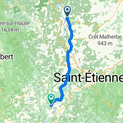
L2: Cleppe-Naconne - La Coteau; 70,3km 760hm
A cycling route starting in Feurs, Auvergne-Rhône-Alpes, France.
Overview
About this route
- -:--
- Duration
- 70.3 km
- Distance
- 849 m
- Ascent
- 903 m
- Descent
- ---
- Avg. speed
- 481 m
- Avg. speed

Route quality
Waytypes & surfaces along the route
Waytypes
Busy road
31.8 km
(45 %)
Road
25.8 km
(37 %)
Surfaces
Paved
13.7 km
(20 %)
Asphalt
13.7 km
(19 %)
Paved (undefined)
0 km
(<1 %)
Undefined
56.6 km
(80 %)
Route highlights
Points of interest along the route
Point of interest after 20.2 km
Strasse mit schönes Aussicht bis Roanne
Point of interest after 21.2 km
Viaduc de Chessieux
Point of interest after 24.4 km
Pont sur Loire
Point of interest after 32.5 km
Saint-Priest Chateau de-la-Roche
Point of interest after 37.8 km
Campingplatz Lademöglichkeit für E-Bikes
Point of interest after 51.9 km
Abstecher zur Gorges
Point of interest after 54 km
Aussichtspunkt zu der Schlucht der Loire
Accommodation after 59.6 km
Logis Hôtel des Lys, Avenue de la Libération, Le Coteau, Frankreich
Continue with Bikemap
Use, edit, or download this cycling route
You would like to ride L2: Cleppe-Naconne - La Coteau; 70,3km 760hm or customize it for your own trip? Here is what you can do with this Bikemap route:
Free features
- Save this route as favorite or in collections
- Copy & plan your own version of this route
- Sync your route with Garmin or Wahoo
Premium features
Free trial for 3 days, or one-time payment. More about Bikemap Premium.
- Navigate this route on iOS & Android
- Export a GPX / KML file of this route
- Create your custom printout (try it for free)
- Download this route for offline navigation
Discover more Premium features.
Get Bikemap PremiumFrom our community
Other popular routes starting in Feurs
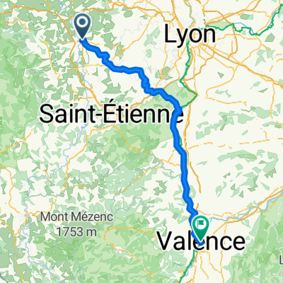
 Feurs to valence
- Distance
- 150.4 km
- Ascent
- 769 m
- Descent
- 995 m
- Location
- Feurs, Auvergne-Rhône-Alpes, France
 20160908_130605.gpx
- Distance
- 14 km
- Ascent
- 96 m
- Descent
- 91 m
- Location
- Feurs, Auvergne-Rhône-Alpes, France
 LV06 Feurs to Roanne.kml - LV06 Feurs to Roanne.kml_LV06 Feurs to Roanne
- Distance
- 63.3 km
- Ascent
- 875 m
- Descent
- 945 m
- Location
- Feurs, Auvergne-Rhône-Alpes, France
 Feurs to valence
- Distance
- 150.6 km
- Ascent
- 752 m
- Descent
- 980 m
- Location
- Feurs, Auvergne-Rhône-Alpes, France
 Le Frog Day 7
- Distance
- 144 km
- Ascent
- 749 m
- Descent
- 979 m
- Location
- Feurs, Auvergne-Rhône-Alpes, France
 2 juni 2022 - km 617 tot 698 - Arlanc
- Distance
- 86 km
- Ascent
- 1,453 m
- Descent
- 1,211 m
- Location
- Feurs, Auvergne-Rhône-Alpes, France
 Feurs St Etienne Le Rhône
- Distance
- 98.2 km
- Ascent
- 903 m
- Descent
- 1,109 m
- Location
- Feurs, Auvergne-Rhône-Alpes, France
 240 Rue du Palais, Civens nach 2–18 Rue du Vieux Puits, Bas-en-Basset
- Distance
- 64.1 km
- Ascent
- 593 m
- Descent
- 472 m
- Location
- Feurs, Auvergne-Rhône-Alpes, France
Open it in the app