

Ausseerland 2
A cycling route starting in Tauplitz, Styria, Austria.
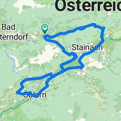
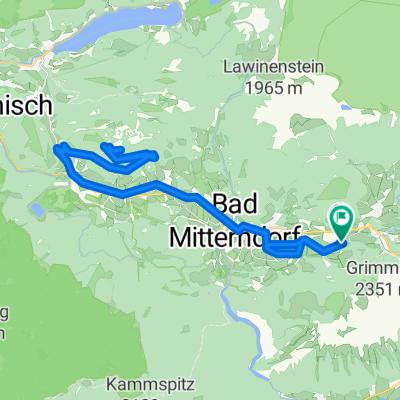
Overview
About this route
Kulmschanze, Bad Mitterndorf, Obersdorf, Knoppen, Äußere Kainisch, Ödensee, Äußere Kainisch, Radling Pass, Radling, Gschlößl, Gruben, Grundlsee, Gößl, Toplitzsee, Gößl, Grundlsee, Untertressen, Obertressen, Bad Aussee, Obertraun, east side of Hallstätter Lake, Steg
- -:--
- Duration
- 74.5 km
- Distance
- 1,051 m
- Ascent
- 1,356 m
- Descent
- ---
- Avg. speed
- 874 m
- Max. altitude

Route quality
Waytypes & surfaces along the route
Waytypes
Quiet road
29.1 km
(39 %)
Track
9.7 km
(13 %)
Surfaces
Paved
41 km
(55 %)
Unpaved
14.2 km
(19 %)
Asphalt
40.2 km
(54 %)
Gravel
11.2 km
(15 %)
Continue with Bikemap
Use, edit, or download this cycling route
You would like to ride Ausseerland 2 or customize it for your own trip? Here is what you can do with this Bikemap route:
Free features
- Save this route as favorite or in collections
- Copy & plan your own version of this route
- Sync your route with Garmin or Wahoo
Premium features
Free trial for 3 days, or one-time payment. More about Bikemap Premium.
- Navigate this route on iOS & Android
- Export a GPX / KML file of this route
- Create your custom printout (try it for free)
- Download this route for offline navigation
Discover more Premium features.
Get Bikemap PremiumFrom our community
Other popular routes starting in Tauplitz
 Tauplitzalm -> Tauplitz
- Distance
- 15.9 km
- Ascent
- 260 m
- Descent
- 984 m
- Location
- Tauplitz, Styria, Austria
 Thörl 3 nach Kurhausplatz 63, Bad Aussee
- Distance
- 31.9 km
- Ascent
- 454 m
- Descent
- 627 m
- Location
- Tauplitz, Styria, Austria
 Okolo Ödensee
- Distance
- 43.7 km
- Ascent
- 643 m
- Descent
- 643 m
- Location
- Tauplitz, Styria, Austria
 Bf. Tauplitz-Spechtensee-EnnstalDo 07.08
- Distance
- 64.4 km
- Ascent
- 1,438 m
- Descent
- 1,438 m
- Location
- Tauplitz, Styria, Austria
 okolo masivu Grimming
- Distance
- 46.5 km
- Ascent
- 477 m
- Descent
- 478 m
- Location
- Tauplitz, Styria, Austria
 2025_08_05_Kulm-Seidenhofalm-Zurück
- Distance
- 50.7 km
- Ascent
- 1,548 m
- Descent
- 1,539 m
- Location
- Tauplitz, Styria, Austria
 Tauplitzalm
- Distance
- 32.3 km
- Ascent
- 1,001 m
- Descent
- 1,002 m
- Location
- Tauplitz, Styria, Austria
 Grimming Runde soft
- Distance
- 16.4 km
- Ascent
- 227 m
- Descent
- 263 m
- Location
- Tauplitz, Styria, Austria
Open it in the app