

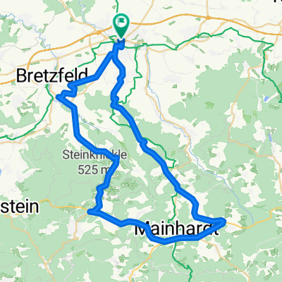
Hohenloher Limes
A cycling route starting in Öhringen, Baden-Wurttemberg, Germany.
Overview
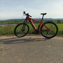
About this route
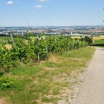
S-Bahn station ÖHR - on the Limes hiking trail to Sindringen - on a gravel bike path to Ohrnberg - on a hiking route with a blue crossbar to Öhringen
- -:--
- Duration
- 27 km
- Distance
- 420 m
- Ascent
- 420 m
- Descent
- ---
- Avg. speed
- ---
- Max. altitude

Route highlights
Points of interest along the route
Point of interest after 0 km
S-Bahn-Haltepunkt
Point of interest after 4.4 km
Römischer Wachtturm
Point of interest after 8.2 km
Römischer Wachturm
Point of interest after 8.7 km
Röm. Wachtturm
Point of interest after 24 km
Aussichtspunkt Möhrig
Continue with Bikemap
Use, edit, or download this cycling route
You would like to ride Hohenloher Limes or customize it for your own trip? Here is what you can do with this Bikemap route:
Free features
- Save this route as favorite or in collections
- Copy & plan your own version of this route
- Sync your route with Garmin or Wahoo
Premium features
Free trial for 3 days, or one-time payment. More about Bikemap Premium.
- Navigate this route on iOS & Android
- Export a GPX / KML file of this route
- Create your custom printout (try it for free)
- Download this route for offline navigation
Discover more Premium features.
Get Bikemap PremiumFrom our community
Other popular routes starting in Öhringen
 Im Möhriger Feld 2, Öhringen to Lindenallee 8, Öhringen
- Distance
- 6.3 km
- Ascent
- 92 m
- Descent
- 96 m
- Location
- Öhringen, Baden-Wurttemberg, Germany
 QuickClimb Öhringen
- Distance
- 13.4 km
- Ascent
- 258 m
- Descent
- 263 m
- Location
- Öhringen, Baden-Wurttemberg, Germany
 kurze Runde bei 34 C
- Distance
- 19.4 km
- Ascent
- 281 m
- Descent
- 297 m
- Location
- Öhringen, Baden-Wurttemberg, Germany
 Öhringen - Unterheimbach - Mainhardt - Gleichen - Heuberg - Öhringen
- Distance
- 49.6 km
- Ascent
- 484 m
- Descent
- 485 m
- Location
- Öhringen, Baden-Wurttemberg, Germany
 Kochertour
- Distance
- 83.2 km
- Ascent
- 328 m
- Descent
- 330 m
- Location
- Öhringen, Baden-Wurttemberg, Germany
 Öhringen Sindringen Ohrnberg
- Distance
- 31.1 km
- Ascent
- 275 m
- Descent
- 261 m
- Location
- Öhringen, Baden-Wurttemberg, Germany
 Pfedelbach-01
- Distance
- 41.9 km
- Ascent
- 585 m
- Descent
- 583 m
- Location
- Öhringen, Baden-Wurttemberg, Germany
 Hohenloher Limes
- Distance
- 27 km
- Ascent
- 420 m
- Descent
- 420 m
- Location
- Öhringen, Baden-Wurttemberg, Germany
Open it in the app