2806 Homestead Rd S, Salem to 2701–2903 Homestead Rd S, Salem
A cycling route starting in Salem, Oregon, United States of America.
Overview
About this route
- 3 h 8 min
- Duration
- 44.5 km
- Distance
- 217 m
- Ascent
- 218 m
- Descent
- 14.2 km/h
- Avg. speed
- 82 m
- Max. altitude
Route quality
Waytypes & surfaces along the route
Waytypes
Busy road
15 km
(34 %)
Road
10.9 km
(25 %)
Surfaces
Paved
23.2 km
(52 %)
Unpaved
0 km
(<1 %)
Paved (undefined)
17.1 km
(39 %)
Asphalt
3.2 km
(7 %)
Continue with Bikemap
Use, edit, or download this cycling route
You would like to ride 2806 Homestead Rd S, Salem to 2701–2903 Homestead Rd S, Salem or customize it for your own trip? Here is what you can do with this Bikemap route:
Free features
- Save this route as favorite or in collections
- Copy & plan your own version of this route
- Sync your route with Garmin or Wahoo
Premium features
Free trial for 3 days, or one-time payment. More about Bikemap Premium.
- Navigate this route on iOS & Android
- Export a GPX / KML file of this route
- Create your custom printout (try it for free)
- Download this route for offline navigation
Discover more Premium features.
Get Bikemap PremiumFrom our community
Other popular routes starting in Salem
- Enchanted forest
- Distance
- 11.2 km
- Ascent
- 158 m
- Descent
- 165 m
- Location
- Salem, Oregon, United States of America
- Minto Browns
- Distance
- 7.6 km
- Ascent
- 19 m
- Descent
- 18 m
- Location
- Salem, Oregon, United States of America
- 3024–3072 12th St SE, Salem to 155 Lancaster Dr SE, Salem
- Distance
- 6 km
- Ascent
- 19 m
- Descent
- 22 m
- Location
- Salem, Oregon, United States of America
- 2806 Homestead Rd S, Salem to 2701–2903 Homestead Rd S, Salem
- Distance
- 44.5 km
- Ascent
- 217 m
- Descent
- 218 m
- Location
- Salem, Oregon, United States of America
- Moderate route in Salem
- Distance
- 2 km
- Ascent
- 0 m
- Descent
- 0 m
- Location
- Salem, Oregon, United States of America
- Commercial Street Northeast 1865, Salem to Lee Street Southeast 1110, Salem
- Distance
- 6.7 km
- Ascent
- 36 m
- Descent
- 29 m
- Location
- Salem, Oregon, United States of America
- 2928 Gehlar Rd NW, Salem to 390 High St NE, Salem
- Distance
- 5.6 km
- Ascent
- 18 m
- Descent
- 116 m
- Location
- Salem, Oregon, United States of America
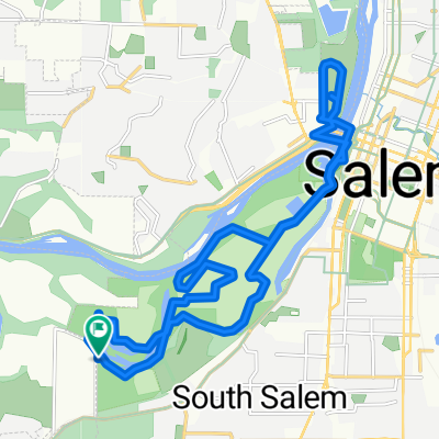
- Salem - Monmouth Route
- Distance
- 47.3 km
- Ascent
- 198 m
- Descent
- 192 m
- Location
- Salem, Oregon, United States of America
Open it in the app