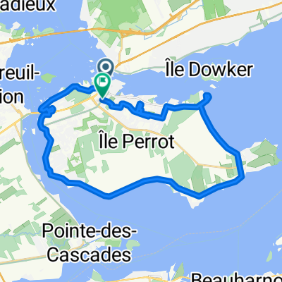
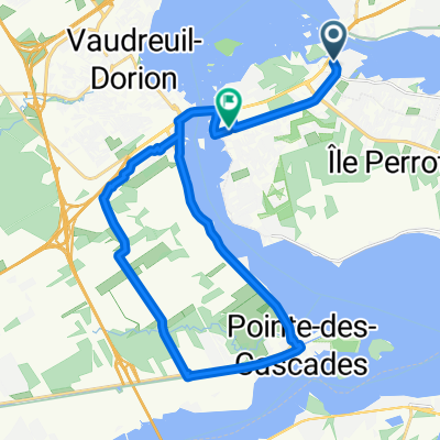
August 2011 trip
A cycling route starting in Sainte-Anne-de-Bellevue, Quebec, Canada.
Overview
About this route
- -:--
- Duration
- 473.2 km
- Distance
- 238 m
- Ascent
- 238 m
- Descent
- ---
- Avg. speed
- ---
- Avg. speed
Route quality
Waytypes & surfaces along the route
Waytypes
Busy road
146.3 km
(31 %)
Quiet road
119 km
(25 %)
Surfaces
Paved
423.3 km
(89 %)
Unpaved
12.8 km
(3 %)
Asphalt
365.5 km
(77 %)
Paved (undefined)
54.7 km
(12 %)
Route highlights
Points of interest along the route
Point of interest after 0.2 km
Day1, Monday, departure 13:00
Point of interest after 1.2 km
Day 1, lunch at Smoke Meat Pete's
Point of interest after 5.3 km
Stopped at Canadian Tire for inner tube
Point of interest after 19.4 km
Major construction, detour, rain storm
Point of interest after 31.4 km
Point of interest after 33.3 km
Day 1, CĂ´teau-du-Lac, 16:19
Point of interest after 95.2 km
Day 1, 19:10, supper at Dairy Queen
Point of interest after 101.4 km
Day 2, Departure from campground 6:45
Point of interest after 101.9 km
Day 1, end at 20:00, sleep at Charlottenburgh Park Campground
Point of interest after 120.1 km
Day 2, Breakfast, King George Restaurant, 8:30
Point of interest after 213.2 km
Day 2, Slept behind a house on a small dirt road.
Point of interest after 291.8 km
Day 3, Sleep in motel because of impending storms
Point of interest after 406.3 km
Missing bridge on dirt road, passed on foot with bike
Point of interest after 413.6 km
Day 4, end, Slept at top of sloping clover field.
Point of interest after 472.4 km
Day 1, before departure, fixed flat tire before leaving, at garage
Continue with Bikemap
Use, edit, or download this cycling route
You would like to ride August 2011 trip or customize it for your own trip? Here is what you can do with this Bikemap route:
Free features
- Save this route as favorite or in collections
- Copy & plan your own version of this route
- Sync your route with Garmin or Wahoo
Premium features
Free trial for 3 days, or one-time payment. More about Bikemap Premium.
- Navigate this route on iOS & Android
- Export a GPX / KML file of this route
- Create your custom printout (try it for free)
- Download this route for offline navigation
Discover more Premium features.
Get Bikemap PremiumFrom our community
Other popular routes starting in Sainte-Anne-de-Bellevue
- 9 June 2020 - Pointe Fortune - Mando
- Distance
- 108.4 km
- Ascent
- 225 m
- Descent
- 222 m
- Location
- Sainte-Anne-de-Bellevue, Quebec, Canada
- 167 Rue Sainte-Anne, Sainte-Anne-de-Bellevue to 167 Rue Sainte-Anne, Sainte-Anne-de-Bellevue
- Distance
- 24 km
- Ascent
- 58 m
- Descent
- 59 m
- Location
- Sainte-Anne-de-Bellevue, Quebec, Canada
- 23 Rue Maple, Ste-Anne-de-Bellevue to 26 Rue Maple, Ste-Anne-de-Bellevue
- Distance
- 26.4 km
- Ascent
- 35 m
- Descent
- 38 m
- Location
- Sainte-Anne-de-Bellevue, Quebec, Canada
- 04 Aug 2012 Châteauguay valley +
- Distance
- 150.1 km
- Ascent
- 88 m
- Descent
- 88 m
- Location
- Sainte-Anne-de-Bellevue, Quebec, Canada
- 08.11 Parc Cap-Saint-Jacques
- Distance
- 56.3 km
- Ascent
- 91 m
- Descent
- 87 m
- Location
- Sainte-Anne-de-Bellevue, Quebec, Canada
- August 2011 trip
- Distance
- 473.2 km
- Ascent
- 238 m
- Descent
- 238 m
- Location
- Sainte-Anne-de-Bellevue, Quebec, Canada
- Boucle Senneville
- Distance
- 17.7 km
- Ascent
- 70 m
- Descent
- 72 m
- Location
- Sainte-Anne-de-Bellevue, Quebec, Canada
- Ste. Anne de Bellevue-Les Cedres
- Distance
- 45.3 km
- Ascent
- 38 m
- Descent
- 40 m
- Location
- Sainte-Anne-de-Bellevue, Quebec, Canada
Open it in the app