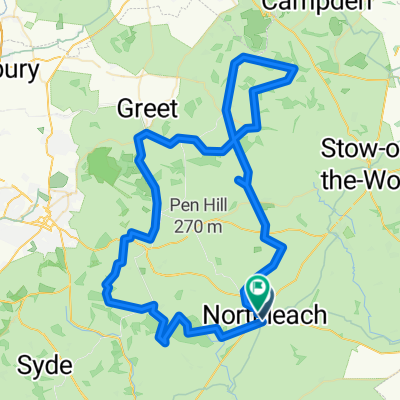
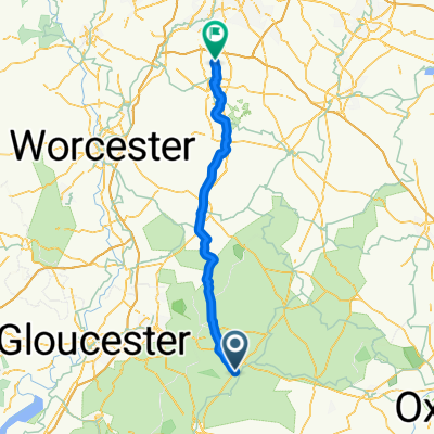
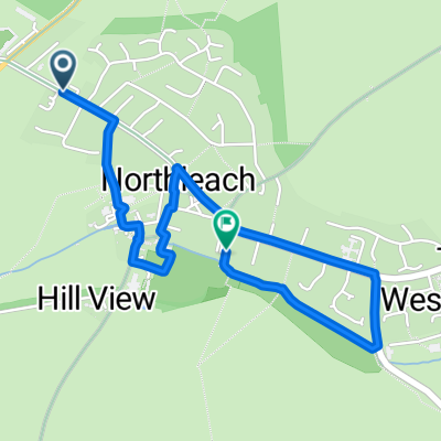
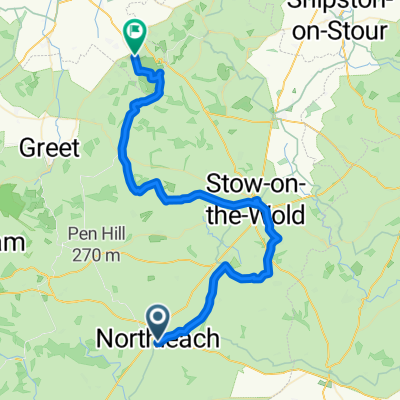
Coln St Dennis, Cheltenham to The Hayloft, 5A Far Peak, Cheltenham
A cycling route starting in Northleach, England, United Kingdom.
Overview
About this route
- 1 h 27 min
- Duration
- 27.8 km
- Distance
- 321 m
- Ascent
- 305 m
- Descent
- 19.2 km/h
- Avg. speed
- 193 m
- Avg. speed
Route quality
Waytypes & surfaces along the route
Waytypes
Quiet road
17.3 km
(62 %)
Road
9.3 km
(33 %)
Surfaces
Paved
3.6 km
(13 %)
Asphalt
3.6 km
(13 %)
Undefined
24.2 km
(87 %)
Continue with Bikemap
Use, edit, or download this cycling route
You would like to ride Coln St Dennis, Cheltenham to The Hayloft, 5A Far Peak, Cheltenham or customize it for your own trip? Here is what you can do with this Bikemap route:
Free features
- Save this route as favorite or in collections
- Copy & plan your own version of this route
- Sync your route with Garmin or Wahoo
Premium features
Free trial for 3 days, or one-time payment. More about Bikemap Premium.
- Navigate this route on iOS & Android
- Export a GPX / KML file of this route
- Create your custom printout (try it for free)
- Download this route for offline navigation
Discover more Premium features.
Get Bikemap PremiumFrom our community
Other popular routes starting in Northleach
- Northleach Winchcombe
- Distance
- 20 km
- Ascent
- 233 m
- Descent
- 303 m
- Location
- Northleach, England, United Kingdom
- Coln St Dennis, Cheltenham to The Hayloft, 5A Far Peak, Cheltenham
- Distance
- 27.8 km
- Ascent
- 321 m
- Descent
- 305 m
- Location
- Northleach, England, United Kingdom
- 4 Chedworth Farm - Tudor caravan Park
- Distance
- 66.7 km
- Ascent
- 186 m
- Descent
- 359 m
- Location
- Northleach, England, United Kingdom
- Cotswaold Lanes around Burford and Northleach
- Distance
- 51.7 km
- Ascent
- 274 m
- Descent
- 274 m
- Location
- Northleach, England, United Kingdom
- Old Fosse Way, Corinium to Bath
- Distance
- 89.8 km
- Ascent
- 777 m
- Descent
- 925 m
- Location
- Northleach, England, United Kingdom
- Bourton circular via Bibury
- Distance
- 9.6 km
- Ascent
- 143 m
- Descent
- 184 m
- Location
- Northleach, England, United Kingdom
- Route 57 full
- Distance
- 105.1 km
- Ascent
- 384 m
- Descent
- 455 m
- Location
- Northleach, England, United Kingdom
- Northleach2
- Distance
- 30.1 km
- Ascent
- 343 m
- Descent
- 343 m
- Location
- Northleach, England, United Kingdom
Open it in the app