

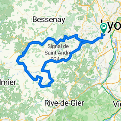
Marseille
A cycling route starting in Sainte-Foy-lès-Lyon, Auvergne-Rhône-Alpes, France.
Overview
About this route
- -:--
- Duration
- 914.5 km
- Distance
- 5,993 m
- Ascent
- 6,137 m
- Descent
- ---
- Avg. speed
- 366 m
- Max. altitude

Route quality
Waytypes & surfaces along the route
Waytypes
Quiet road
274.3 km
(30 %)
Cycleway
256.1 km
(28 %)
Surfaces
Paved
658.4 km
(72 %)
Unpaved
27.4 km
(3 %)
Asphalt
631 km
(69 %)
Paved (undefined)
18.3 km
(2 %)
Continue with Bikemap
Use, edit, or download this cycling route
You would like to ride Marseille or customize it for your own trip? Here is what you can do with this Bikemap route:
Free features
- Save this route as favorite or in collections
- Copy & plan your own version of this route
- Split it into stages to create a multi-day tour
- Sync your route with Garmin or Wahoo
Premium features
Free trial for 3 days, or one-time payment. More about Bikemap Premium.
- Navigate this route on iOS & Android
- Export a GPX / KML file of this route
- Create your custom printout (try it for free)
- Download this route for offline navigation
Discover more Premium features.
Get Bikemap PremiumFrom our community
Other popular routes starting in Sainte-Foy-lès-Lyon
 ETAPPE 7 - Lyon nach Châteauneuf-sur-Isère
- Distance
- 118.9 km
- Ascent
- 370 m
- Descent
- 420 m
- Location
- Sainte-Foy-lès-Lyon, Auvergne-Rhône-Alpes, France
 Marseille
- Distance
- 914.5 km
- Ascent
- 5,993 m
- Descent
- 6,137 m
- Location
- Sainte-Foy-lès-Lyon, Auvergne-Rhône-Alpes, France
 Lyon-Corcelles
- Distance
- 61.9 km
- Ascent
- 189 m
- Descent
- 120 m
- Location
- Sainte-Foy-lès-Lyon, Auvergne-Rhône-Alpes, France
 3. Tag Rhone
- Distance
- 49.2 km
- Ascent
- 496 m
- Descent
- 279 m
- Location
- Sainte-Foy-lès-Lyon, Auvergne-Rhône-Alpes, France
 De 2 Chemin de la Croix Pivort, Sainte-Foy-lès-Lyon à Place du 8 Mai 1945, Chaponost
- Distance
- 7.4 km
- Ascent
- 151 m
- Descent
- 141 m
- Location
- Sainte-Foy-lès-Lyon, Auvergne-Rhône-Alpes, France
 Eastern Europe
- Distance
- 6,682.9 km
- Ascent
- 5,784 m
- Descent
- 5,461 m
- Location
- Sainte-Foy-lès-Lyon, Auvergne-Rhône-Alpes, France
 Toboggan 90Km
- Distance
- 93.7 km
- Ascent
- 2,067 m
- Descent
- 2,098 m
- Location
- Sainte-Foy-lès-Lyon, Auvergne-Rhône-Alpes, France
 Toboggan Fidésien 110Km
- Distance
- 113.3 km
- Ascent
- 2,641 m
- Descent
- 2,667 m
- Location
- Sainte-Foy-lès-Lyon, Auvergne-Rhône-Alpes, France
Open it in the app